 |
|
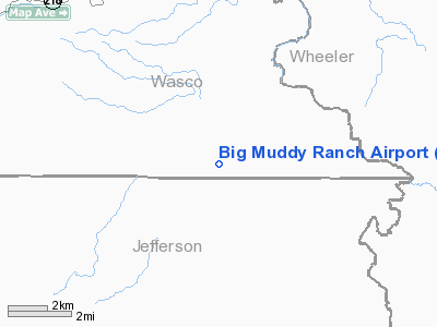
Location & QuickFacts
| FAA Information Effective: | 2008-09-25 |
| Airport Identifier: | 2OR1 |
| Airport Status: | Operational |
| Longitude/Latitude: | 120-29-42.1000W/44-49-42.6000N
-120.495028/44.828500 (Estimated) |
| Elevation: | 1641 ft / 500.18 m (Estimated) |
| Land: | 35 acres |
| From nearest city: | 13 nautical miles SE of Antelope, OR |
| Location: | Wasco County, OR |
| Magnetic Variation: | 18E (1995) |
Owner & Manager
| Ownership: | Privately owned |
| Owner: | Yl's Washington Family Ranch |
| Address: | Po Box 220
Antelope, OR 97001 |
Airport Operations and Facilities
| Airport Use: | Private |
| Wind indicator: | Yes |
| Segmented Circle: | No |
| Control Tower: | No |
| Lighting Schedule: | PHONE REQ
FOR LIRL RY 04/22 CALL 541-489-3100. |
| Sectional chart: | Seattle |
| Region: | ANM - Northwest Mountain |
| Boundary ARTCC: | ZSE - Seattle |
| Tie-in FSS: | MMV - Mc Minnville |
| FSS Toll Free: | 1-800-WX-BRIEF |
Airport Communications
Runway Information
Runway 04/22
| Dimension: | 4185 x 70 ft / 1275.6 x 21.3 m |
| Surface: | ASPH, Good Condition |
| Edge Lights: | Low |
| |
Runway 04 |
Runway 22 |
| Traffic Pattern: | Left | Left |
| Obstruction: | 379 ft hill, 3500.0 ft from runway | 270 ft hill, 3000.0 ft from runway |
|
Radio Navigation Aids
| ID |
Type |
Name |
Ch |
Freq |
Var |
Dist |
| RD | NDB | Bodey | | 411.00 | 18E | 38.5 nm |
| IMB | VORTAC | Kimberly | 103X | 115.60 | 20E | 35.2 nm |
| DSD | VORTAC | Deschutes | 123X | 117.60 | 18E | 49.0 nm |
Remarks
- ARPT SURROUNDED BY HIGH TERRAIN.
Images and information placed above are from
http://www.airport-data.com/airport/2OR1/
We thank them for the data!
|
|


