 |
|
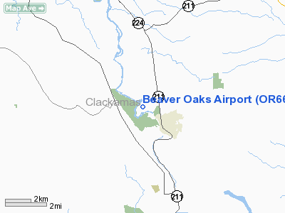
Location & QuickFacts
| FAA Information Effective: | 2008-09-25 |
| Airport Identifier: | OR66 |
| Airport Status: | Operational |
| Longitude/Latitude: | 122-21-39.3080W/45-18-14.4360N
-122.360919/45.304010 (Estimated) |
| Elevation: | 400 ft / 121.92 m (Estimated) |
| Land: | 27 acres |
| From nearest city: | 3 nautical miles NW of Estacada, OR |
| Location: | Clackamas County, OR |
| Magnetic Variation: | 19E (1985) |
Owner & Manager
| Ownership: | Privately owned |
| Owner: | C. R. Gay |
| Address: | 29388 Se Heiple Road
Eagle Creek, OR 97022 |
| Phone number: | 503-630-5867 |
| Address: |
|
Airport Operations and Facilities
| Airport Use: | Private |
| Wind indicator: | Yes |
| Segmented Circle: | No |
| Control Tower: | No |
| Landing fee charge: | No |
| Sectional chart: | Seattle |
| Region: | ANM - Northwest Mountain |
| Traffic Pattern Alt: | 800 ft |
| Boundary ARTCC: | ZSE - Seattle |
| Tie-in FSS: | MMV - Mc Minnville |
| FSS on Airport: | No |
| FSS Toll Free: | 1-800-WX-BRIEF |
Airport Services
| Fuel available: | 80
FUEL AVBL PRIOR REQ CALL 503-630-5867. |
Runway Information
Runway 15/33
| Dimension: | 1700 x 75 ft / 518.2 x 22.9 m |
| Surface: | TURF, |
| |
Runway 15 |
Runway 33 |
| Traffic Pattern: | Left | Right |
|
Radio Navigation Aids
| ID |
Type |
Name |
Ch |
Freq |
Var |
Dist |
| LBH | NDB | Laker | | 332.00 | 20E | 14.9 nm |
| PND | NDB | Banks | | 356.00 | 21E | 34.9 nm |
| CBU | TACAN | Columbia | 029X | | 20E | 20.1 nm |
| PDX | VOR/DME | Portland | 055X | 111.80 | 20E | 20.3 nm |
| UBG | VOR/DME | Newberg | 121X | 117.40 | 21E | 26.3 nm |
| BTG | VORTAC | Battle Ground | 113X | 116.60 | 21E | 28.4 nm |
| PDX | VOT | Portland Intl | | 111.00 | | 20.4 nm |
| HIO | VOT | Portland-hillsboro | | 115.20 | | 28.6 nm |
Remarks
Images and information placed above are from
http://www.airport-data.com/airport/OR66/
We thank them for the data!
| General Info
|
| Country |
United States
|
| State |
OREGON
|
| FAA ID |
OR66
|
| Latitude |
45-18-14.436N
|
| Longitude |
122-21-39.308W
|
| Elevation |
400 feet
|
| Near City |
ESTACADA
|
We don't guarantee the information is fresh and accurate. The data may
be wrong or outdated.
For more up-to-date information please refer to other sources.
|
|


