 |
|
Location & QuickFacts
| FAA Information Effective: | 2008-09-25 |
| Airport Identifier: | OG45 |
| Airport Status: | Operational |
| Longitude/Latitude: | 117-52-19.0000W/44-37-01.0000N
-117.871944/44.616944 (Estimated) |
| Elevation: | 4640 ft / 1414.27 m (Estimated) |
| Land: | 5 acres |
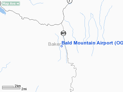
| From nearest city: | 11 nautical miles S of Baker City, OR |
| Location: | Baker County, OR |
| Magnetic Variation: | () |
Owner & Manager
| Ownership: | Privately owned |
| Owner: | Raymond & Sharell Blomquist |
| Address: | 36036 Hwy 245
Baker City, OR 97814-7742 |
| Phone number: | 541-755-6185 |
| Manager: | Raymond Blomquist |
| Address: | 36036 Hwy 245
Baker City, OR 97814-7742 |
| Phone number: | 541-755-6185 |
Airport Operations and Facilities
| Airport Use: | Private |
| Wind indicator: | Yes |
| Segmented Circle: | No |
| Control Tower: | No |
| Sectional chart: | Seattle |
| Region: | ANM - Northwest Mountain |
| Boundary ARTCC: | ZLC - Salt Lake City |
| Tie-in FSS: | MMV - Mc Minnville |
| FSS Toll Free: | 1-800-WX-BRIEF |
Runway Information
Runway 17/35
| Dimension: | 2700 x 60 ft / 823.0 x 18.3 m |
| Surface: | TURF-DIRT, |
| |
Runway 17 |
Runway 35 |
| Traffic Pattern: | Left | Left |
| Obstruction: | | 60 ft trees, 300.0 ft from runway |
|
Radio Navigation Aids
| ID |
Type |
Name |
Ch |
Freq |
Var |
Dist |
| LGD | NDB | La Grande | | 296.00 | 17E | 43.8 nm |
| BKE | VOR/DME | Baker City | 100X | 115.30 | 20E | 13.7 nm |
Remarks
- TAKEOFF TO THE NORTH; LAND TO THE SOUTH.
Images and information placed above are from
http://www.airport-data.com/airport/OG45/
We thank them for the data!
|
|


