|
|
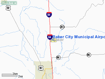
| Baker City Municipal Airport |
| IATA: BKE – ICAO: KBKE |
| Summary |
| Airport type |
Public |
| Operator |
Baker City |
| Location |
Baker City, Oregon |
| Elevation AMSL |
1028.1 ft / 313 m |
| Coordinates |
44°50′14.4000″N 117°48′32.7000″W / 44.837333°N 117.809083°W / 44.837333; -117.809083Coordinates: 44°50′14.4000″N 117°48′32.7000″W / 44.837333°N 117.809083°W / 44.837333; -117.809083 |
| Runways |
| Direction |
Length |
Surface |
| ft |
m |
| 13/31 |
5095 |
1553 |
Asphalt |
| 17/35 |
4359 |
1329 |
Asphalt |
| 8/26 |
3999 |
1219 |
Asphalt |
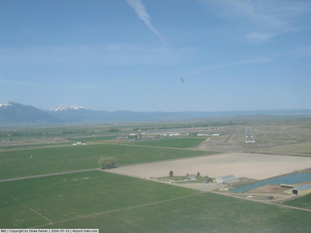
Baker City Municipal Airport (IATA: BKE, ICAO: KBKE), is a public airport located three miles (4.8 km) north of the city of Baker in Baker County, Oregon, USA.
The above content comes from Wikipedia and is published under free licenses – click here to read more.
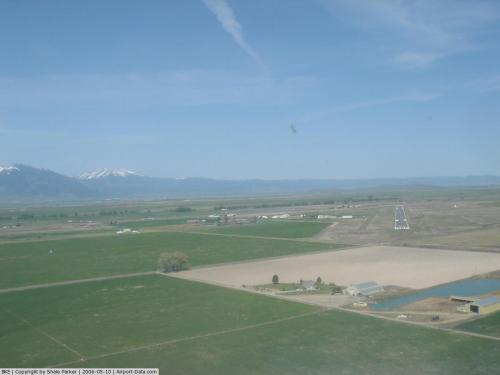 |
(Click on the photo to enlarge) |
Location & QuickFacts
| FAA Information Effective: | 2008-09-25 |
| Airport Identifier: | BKE |
| Airport Status: | Operational |
| Longitude/Latitude: | 117-48-32.9190W/44-50-14.4599N
-117.809144/44.837350 (Estimated) |
| Elevation: | 3373 ft / 1028.09 m (Surveyed) |
| Land: | 398 acres |
| From nearest city: | 3 nautical miles N of Baker City, OR |
| Location: | Baker County, OR |
| Magnetic Variation: | 16E (2005) |
Owner & Manager
| Ownership: | Publicly owned |
| Owner: | Baker City |
| Address: | Box 650
Baker City 0r 97814 |
| Phone number: | 541-523-6541 |
| Manager: | Troy Woydziak
ALSO MICHELLE OWEN (DIR. OF PUBLIC WORKS) 541-523-6541. |
| Address: | Box 650
Baker City, OR 97814 |
| Phone number: | 541-523-6541 |
Airport Operations and Facilities
| Airport Use: | Open to public |
| Wind indicator: | Yes |
| Segmented Circle: | Yes |
| Control Tower: | No |
| Lighting Schedule: | DUSK-DAWN
ACTVT MIRL RY 13/31 & VASI RY 13 - CTAF. |
| Beacon Color: | Clear-Green (lighted land airport) |
| Landing fee charge: | No |
| Sectional chart: | Seattle |
| Region: | ANM - Northwest Mountain |
| Boundary ARTCC: | ZLC - Salt Lake City |
| Tie-in FSS: | MMV - Mc Minnville |
| FSS on Airport: | No |
| FSS Toll Free: | 1-800-WX-BRIEF |
| NOTAMs Facility: | BKE (NOTAM-d service avaliable) |
| Federal Agreements: | NGPY3 |
Airport Communications
| CTAF: | 123.000 |
| Unicom: | 123.000 |
Airport Services
| Fuel available: | 100LLA |
| Airframe Repair: | MINOR |
| Power Plant Repair: | MINOR |
| Bottled Oxygen: | NONE |
| Bulk Oxygen: | NONE |
Runway Information
Runway 08/26
| Dimension: | 3670 x 140 ft / 1118.6 x 42.7 m |
| Surface: | ASPH, Poor Condition
HAS MANY LARGE UNSEALED CRACKS; GRASS GROWING ON RY; STANDING WATER ON SURFACE. |
| Weight Limit: | Single wheel: 30000 lbs. |
| |
Runway 08 |
Runway 26 |
| Longitude: | 117-48-51.3883W | 117-48-00.8262W |
| Latitude: | 44-50-12.9270N | 44-50-08.6721N |
| Elevation: | 3370.00 ft | 3369.00 ft |
| Alignment: | 97 | 127 |
| Traffic Pattern: | Left | Left |
| Markings: | Numbers only, Fair Condition | Numbers only, Fair Condition |
| Obstruction: | 21 ft road, 250.0 ft from runway, 2:1 slope to clear
APCH RATIO 18:1 BASED ON DSPLCD THLD.
RWY 08 +25 FT TREE 275 FT FRM RY END; 140 FT LEFT. | 32 ft pline, 1500.0 ft from runway, 40:1 slope to clear
RWY 26 +14 FT ROAD; DIST 290 FT; ON CNTRLN; 20:1 BASED ON DSPLCD THLD.
+14 FT ROAD AT 100 FT ON CNTRLN. |
|
Runway 13/31
| Dimension: | 5095 x 100 ft / 1553.0 x 30.5 m |
| Surface: | ASPH, Good Condition
HAS MANY LARGE UNSEALED CRACKS; GRASS GROWING ON RY; STANDING WATER ON SURFACE. |
| Weight Limit: | Single wheel: 50000 lbs.
Dual wheel: 65000 lbs. |
| Edge Lights: | Medium |
| |
Runway 13 |
Runway 31 |
| Longitude: | 117-48-48.2810W | 117-48-04.3040W |
| Latitude: | 44-50-32.1700N | 44-49-52.7890N |
| Elevation: | 3366.00 ft | 3373.00 ft |
| Alignment: | 127 | 127 |
| Traffic Pattern: | Left | Left |
| Markings: | Non-precision instrument, Good Condition | Basic, Good Condition |
| Crossing Height: | 55.00 ft | 0.00 ft |
| VASI: | 4-box on left side | |
| Visual Glide Angle: | 3.00° | 0.00° |
| Obstruction: | 20 ft trees, 470.0 ft from runway, 230 ft right of centerline, 13:1 slope to clear | 15 ft road, 530.0 ft from runway, 283 ft right of centerline, 22:1 slope to clear |
|
Runway 17/35
| Dimension: | 4359 x 75 ft / 1328.6 x 22.9 m |
| Surface: | ASPH, Good Condition
HAS MANY LARGE UNSEALED CRACKS; GRASS GROWING ON RY; STANDING WATER ON SURFACE. |
| Weight Limit: | Single wheel: 30000 lbs. |
| |
Runway 17 |
Runway 35 |
| Longitude: | 117-48-45.7675W | 117-48-47.0315W |
| Latitude: | 44-50-41.3697N | 44-49-58.3434N |
| Elevation: | 3366.00 ft | 3373.00 ft |
| Alignment: | 127 | 1 |
| Traffic Pattern: | Left | Left |
| Markings: | Basic, Good Condition | Basic, Good Condition |
| Displaced threshold: | 0.00 ft | 397.00 ft |
| Obstruction: | 20 ft trees, 650.0 ft from runway, 75 ft left of centerline, 22:1 slope to clear | , 50:1 slope to clear |
|
Radio Navigation Aids
| ID |
Type |
Name |
Ch |
Freq |
Var |
Dist |
| LGD | NDB | La Grande | | 296.00 | 17E | 31.1 nm |
| BKE | VOR/DME | Baker City | 100X | 115.30 | 20E | 0.2 nm |
Remarks
- RYS 08/26 & 17/35 NO WINTER MAINTENANCE; CLSD BY SNOW.
- BIRDS INVOF APRT.
- RY 13/31 PARALLEL TWY MKD WITH REFLECTORS.
- ESTABD PRIOR TO 15 MAY 1959.
Images and information placed above are from
http://www.airport-data.com/airport/BKE/
We thank them for the data!
| General Info
|
| Country |
United States
|
| State |
OREGON
|
| FAA ID |
BKE
|
| Latitude |
44-50-14.400N
|
| Longitude |
117-48-32.700W
|
| Elevation |
3373 feet
|
| Near City |
BAKER CITY
|
We don't guarantee the information is fresh and accurate. The data may
be wrong or outdated.
For more up-to-date information please refer to other sources.
|
|