 |
|
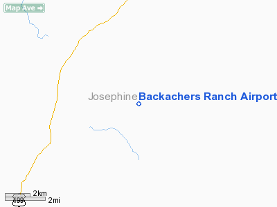
Location & QuickFacts
| FAA Information Effective: | 2008-09-25 |
| Airport Identifier: | 5OR0 |
| Airport Status: | Operational |
| Longitude/Latitude: | 123-31-59.2320W/42-17-06.4130N
-123.533120/42.285115 (Estimated) |
| Elevation: | 1460 ft / 445.01 m (Estimated) |
| Land: | 0 acres |
| From nearest city: | 4 nautical miles E of Selma, OR |
| Location: | Josephine County, OR |
| Magnetic Variation: | 18E (1985) |
Owner & Manager
| Ownership: | Privately owned |
| Owner: | Robert Bleadon |
| Address: | 3569 Amber Lane
Grants Pass, OR 97526 |
| Phone number: | 503-479-6005 |
| Manager: | Robert Bleadon |
| Address: | 4334 Deer Creek Rd.
Swlma, OR 97526 |
| Phone number: | 503-597-4770 |
Airport Operations and Facilities
| Airport Use: | Private |
| Wind indicator: | Yes |
| Segmented Circle: | No |
| Control Tower: | No |
| Landing fee charge: | No |
| Sectional chart: | Klamath Falls |
| Region: | ANM - Northwest Mountain |
| Boundary ARTCC: | ZSE - Seattle |
| Tie-in FSS: | MMV - Mc Minnville |
| FSS on Airport: | No |
| FSS Toll Free: | 1-800-WX-BRIEF |
Runway Information
Runway 02/20
| Dimension: | 2400 x 50 ft / 731.5 x 15.2 m |
| Surface: | TURF, |
| |
Runway 02 |
Runway 20 |
| Traffic Pattern: | Left | Left |
|
Radio Navigation Aids
| ID |
Type |
Name |
Ch |
Freq |
Var |
Dist |
| MEF | NDB | Medford | | 356.00 | 19E | 29.8 nm |
| OED | VORTAC | Rogue Valley | 083X | 113.60 | 19E | 29.9 nm |
| CEC | VORTAC | Crescent City | 027X | 109.00 | 19E | 43.8 nm |
| MFR | VOT | Medford-jackson County | | 117.20 | | 30.0 nm |
Remarks
Images and information placed above are from
http://www.airport-data.com/airport/5OR0/
We thank them for the data!
| General Info
|
| Country |
United States
|
| State |
OREGON
|
| FAA ID |
5OR0
|
| Latitude |
42-17-06.413N
|
| Longitude |
123-31-59.232W
|
| Elevation |
1460 feet
|
| Near City |
SELMA
|
We don't guarantee the information is fresh and accurate. The data may
be wrong or outdated.
For more up-to-date information please refer to other sources.
|
|


