 |
|
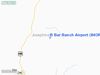
Location & QuickFacts
| FAA Information Effective: | 2008-09-25 |
| Airport Identifier: | 84OR |
| Airport Status: | Operational |
| Longitude/Latitude: | 123-34-10.2350W/42-14-51.4110N
-123.569510/42.247614 (Estimated) |
| Elevation: | 1400 ft / 426.72 m (Estimated) |
| Land: | 0 acres |
| From nearest city: | 3 nautical miles SE of Selma, OR |
| Location: | Josephine County, OR |
| Magnetic Variation: | 18E (1985) |
Owner & Manager
| Ownership: | Privately owned |
| Owner: | Rex V. Bixby |
| Address: | Po Box 280
Selma, OR 97538 |
| Phone number: | 503-597-2418 |
| Address: |
|
Airport Operations and Facilities
| Airport Use: | Private |
| Segmented Circle: | No |
| Control Tower: | No |
| Landing fee charge: | No |
| Sectional chart: | Klamath Falls |
| Region: | ANM - Northwest Mountain |
| Boundary ARTCC: | ZSE - Seattle |
| Tie-in FSS: | MMV - Mc Minnville |
| FSS Toll Free: | 1-800-WX-BRIEF |
Runway Information
Runway 17/35
| Dimension: | 1500 x 40 ft / 457.2 x 12.2 m |
| Surface: | TURF, |
| |
Runway 17 |
Runway 35 |
| Traffic Pattern: | Left | Left |
| Obstruction: | | 35 ft pline, 110.0 ft from runway |
|
Radio Navigation Aids
| ID |
Type |
Name |
Ch |
Freq |
Var |
Dist |
| MEF | NDB | Medford | | 356.00 | 19E | 31.9 nm |
| OED | VORTAC | Rogue Valley | 083X | 113.60 | 19E | 32.3 nm |
| CEC | VORTAC | Crescent City | 027X | 109.00 | 19E | 41.1 nm |
| MFR | VOT | Medford-jackson County | | 117.20 | | 32.0 nm |
Images and information placed above are from
http://www.airport-data.com/airport/84OR/
We thank them for the data!
|
|


