 |
|
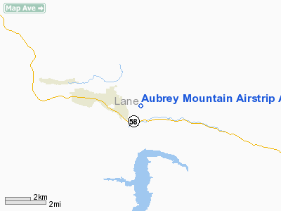
Aubrey Mountain Airstrip Airport |
Location & QuickFacts
| FAA Information Effective: | 2008-09-25 |
| Airport Identifier: | 13OR |
| Airport Status: | Operational |
| Longitude/Latitude: | 122-25-35.1710W/43-44-26.4440N
-122.426436/43.740679 (Estimated) |
| Elevation: | 1680 ft / 512.06 m (Estimated) |
| Land: | 78 acres |
| From nearest city: | 2 nautical miles E of Oakridge, OR |
| Location: | Lane County, OR |
| Magnetic Variation: | 19E (1985) |
Owner & Manager
| Ownership: | Privately owned |
| Owner: | Even L. Kjornes
ADDITIONAL OWNERS: LELAND HOST, BOX 1046, OAKRIDGE, OR 97463: AND JEFFRY & KIM ALLEN, P.O. BOX 581, OAKRIDGE, OR 97463. |
| Address: | 49077 Dunning Road
Oakridge, OR 97463 |
| Phone number: | 503-782-2452 |
| Manager: | Even L. Kjornes |
| Address: | 49077 Dunning Road
Oakridge, OR 97463 |
| Phone number: | 503-782-2452 |
Airport Operations and Facilities
| Airport Use: | Private |
| Wind indicator: | Yes |
| Segmented Circle: | No |
| Control Tower: | No |
| Landing fee charge: | No |
| Sectional chart: | Klamath Falls |
| Region: | ANM - Northwest Mountain |
| Boundary ARTCC: | ZSE - Seattle |
| Tie-in FSS: | MMV - Mc Minnville |
| FSS on Airport: | No |
| FSS Toll Free: | 1-800-WX-BRIEF |
Runway Information
Runway 12/30
| Dimension: | 1950 x 40 ft / 594.4 x 12.2 m |
| Surface: | TURF, |
| |
Runway 12 |
Runway 30 |
| Traffic Pattern: | Left | Left |
|
Radio Navigation Aids
| ID |
Type |
Name |
Ch |
Freq |
Var |
Dist |
| EU | NDB | Frakk | | 260.00 | 19E | 44.6 nm |
| EUG | VORTAC | Eugene | 076X | 112.90 | 20E | 41.4 nm |
Images and information placed above are from
http://www.airport-data.com/airport/13OR/
We thank them for the data!
| General Info
|
| Country |
United States
|
| State |
OREGON
|
| FAA ID |
13OR
|
| Latitude |
43-44-26.444N
|
| Longitude |
122-25-35.171W
|
| Elevation |
1680 feet
|
| Near City |
OAKRIDGE
|
We don't guarantee the information is fresh and accurate. The data may
be wrong or outdated.
For more up-to-date information please refer to other sources.
|
|


