 |
|
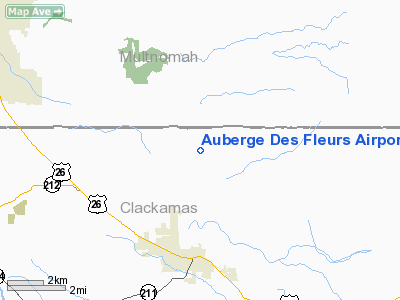
Auberge Des Fleurs Airport |
Location & QuickFacts
| FAA Information Effective: | 2008-09-25 |
| Airport Identifier: | 4OR6 |
| Airport Status: | Operational |
| Longitude/Latitude: | 122-15-15.3210W/45-26-59.4340N
-122.254256/45.449843 (Estimated) |
| Elevation: | 510 ft / 155.45 m (Estimated) |
| Land: | 60 acres |
| From nearest city: | 4 nautical miles N of Sandy, OR |
| Location: | Clackamas County, OR |
| Magnetic Variation: | 19E (1990) |
Owner & Manager
| Ownership: | Privately owned |
| Owner: | Flynn Rainbow Nurseries Inc. |
| Address: | 39391 S.e. Lusted Road
Sandy, OR 97055 |
| Phone number: | 503-663-3133
OR 503-663-9449. |
| Manager: | Donald Flynn |
| Address: | 39391 S.e. Lusted Road
Sandy, OR 97055 |
| Phone number: | 503-663-3133
OR 503-663-9449 OR 503-663-4949. |
Airport Operations and Facilities
| Airport Use: | Private |
| Wind indicator: | Yes |
| Segmented Circle: | No |
| Control Tower: | No |
| Sectional chart: | Seattle |
| Region: | ANM - Northwest Mountain |
| Boundary ARTCC: | ZSE - Seattle |
| Tie-in FSS: | MMV - Mc Minnville |
| FSS on Airport: | No |
| FSS Toll Free: | 1-800-WX-BRIEF |
Airport Communications
Runway Information
Runway 09/27
| Dimension: | 1850 x 50 ft / 563.9 x 15.2 m |
| Surface: | TURF, |
| |
Runway 09 |
Runway 27 |
| Traffic Pattern: | Left | Left |
| Obstruction: | 100 ft trees, 50.0 ft from runway | |
|
Radio Navigation Aids
| ID |
Type |
Name |
Ch |
Freq |
Var |
Dist |
| LBH | NDB | Laker | | 332.00 | 20E | 10.3 nm |
| PND | NDB | Banks | | 356.00 | 21E | 35.0 nm |
| CBU | TACAN | Columbia | 029X | | 20E | 17.2 nm |
| PDX | VOR/DME | Portland | 055X | 111.80 | 20E | 17.2 nm |
| UBG | VOR/DME | Newberg | 121X | 117.40 | 21E | 31.1 nm |
| BTG | VORTAC | Battle Ground | 113X | 116.60 | 21E | 22.8 nm |
| PDX | VOT | Portland Intl | | 111.00 | | 17.1 nm |
| HIO | VOT | Portland-hillsboro | | 115.20 | | 29.8 nm |
Remarks
- WATCH FOR BIRDS; ANIMALS; WORKERS & FARM EQUIPMENT ON ARPT.
- PRVDD TFC PATTERNS ARE EST FOR N SIDE.
Images and information placed above are from
http://www.airport-data.com/airport/4OR6/
We thank them for the data!
| General Info
|
| Country |
United States
|
| State |
OREGON
|
| FAA ID |
4OR6
|
| Latitude |
45-26-59.434N
|
| Longitude |
122-15-15.321W
|
| Elevation |
510 feet
|
| Near City |
SANDY
|
We don't guarantee the information is fresh and accurate. The data may
be wrong or outdated.
For more up-to-date information please refer to other sources.
|
|


