 |
|
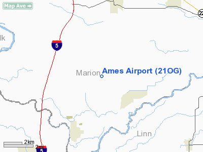
Location & QuickFacts
| FAA Information Effective: | 2008-09-25 |
| Airport Identifier: | 21OG |
| Airport Status: | Operational |
| Longitude/Latitude: | 122-58-10.0000W/44-46-18.5000N
-122.969444/44.771806 (Estimated) |
| Elevation: | 720 ft / 219.46 m (Estimated) |
| Land: | 2 acres |
| From nearest city: | 4 nautical miles NE of Jefferson, OR |
| Location: | Marion County, OR |
| Magnetic Variation: | () |
Owner & Manager
| Ownership: | Privately owned |
| Owner: | William Ames Curtright |
| Address: | 4135 Paradise Hill Dr Se
Turner, OR 97392 |
| Phone number: | 503-209-7388 |
| Manager: | William Ames Curtright |
| Address: | 4135 Paradise Hill Dr Se
Turner, OR 97392 |
| Phone number: | 503-209-7388 |
Airport Operations and Facilities
| Airport Use: | Private |
| Control Tower: | No |
| Sectional chart: | Seattle |
| Region: | ANM - Northwest Mountain |
| Boundary ARTCC: | ZSE - Seattle |
| Tie-in FSS: | MMV - Mc Minnville |
| FSS Toll Free: | 1-800-WX-BRIEF |
Runway Information
Runway 14/32
| Dimension: | 1800 x 40 ft / 548.6 x 12.2 m |
| Surface: | ASPH, |
| |
Runway 14 |
Runway 32 |
| Traffic Pattern: | Left | Left |
|
Radio Navigation Aids
| ID |
Type |
Name |
Ch |
Freq |
Var |
Dist |
| LWG | NDB | Lewisburg | | 225.00 | 18E | 16.0 nm |
| EU | NDB | Frakk | | 260.00 | 19E | 35.3 nm |
| CVO | VOR/DME | Corvallis | 101X | 115.40 | 18E | 21.4 nm |
| UBG | VOR/DME | Newberg | 121X | 117.40 | 21E | 35.0 nm |
| EUG | VORTAC | Eugene | 076X | 112.90 | 20E | 40.6 nm |
| ONP | VORTAC | Newport | 118X | 117.10 | 19E | 48.1 nm |
| HIO | VOT | Portland-hillsboro | | 115.20 | | 46.2 nm |
Images and information placed above are from
http://www.airport-data.com/airport/21OG/
We thank them for the data!
|
|


