 |
|
Alkali Lake State Airport |
| Alkali Lake State Airport |
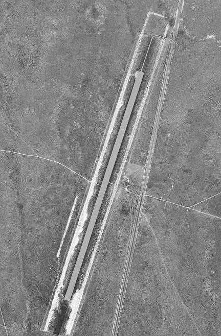 |
| 1994 USGS airphoto |
| IATA: none – ICAO: - FAA: R03 |
| Summary |
| Airport type |
Public |
| Operator |
Oregon Department of Aviation |
| Location |
Lake County, near Wagontire, Oregon |
| Elevation AMSL |
4312 ft / 1314.3 m |
| Coordinates |
43°05′14.5420″N 119°58′33.8640″W / 43.08737278°N 119.97607333°W / 43.08737278; -119.97607333 |
| Runways |
| Direction |
Length |
Surface |
| ft |
m |
| 18/36 |
6100 |
1859 |
Gravel |
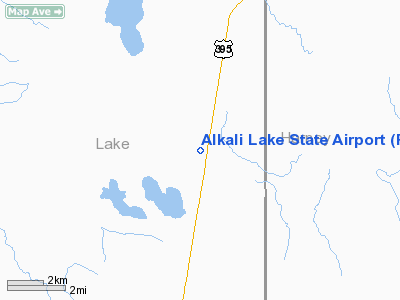
Alkali Lake State Airport (FAA LID: R03), is a public airport located eight miles (12.9 km) northeast of Alkali Lake in Lake County, Oregon, United States.
History
The airport was built by the United States Army Air Force about 1942, and was known as Alkali Lake Flight Strip. It was an emergency landing airfield for military aircraft on training flights. It was closed after World War II, and was turned over for local government use by the War Assets Administration (WAA).
The above content comes from Wikipedia and is published under free licenses – click here to read more.
Location & QuickFacts
| FAA Information Effective: | 2008-09-25 |
| Airport Identifier: | R03 |
| Airport Status: | Operational |
| Longitude/Latitude: | 119-58-33.8640W/43-05-14.5420N
-119.976073/43.087373 (Estimated) |
| Elevation: | 4312 ft / 1314.30 m (Surveyed) |
| Land: | 147 acres |
| From nearest city: | 8 nautical miles N of Alkali Lake, OR |
| Location: | Lake County, OR |
| Magnetic Variation: | 18E (1985) |
Owner & Manager
| Ownership: | Publicly owned |
| Owner: | Oregon Dept Of Aviation |
| Address: | 3040 25th St, Se
Salem, OR 97310 |
| Phone number: | 503-378-4880 |
| Manager: | State Airports Mgr |
| Address: | 3040 25th St, Se
Salem, OR 97310 |
| Phone number: | 503-378-4880 |
Airport Operations and Facilities
| Airport Use: | Open to public |
| Wind indicator: | Yes
WSK MIDFIELD WEST SIDE. |
| Segmented Circle: | No |
| Control Tower: | No |
| Landing fee charge: | No |
| Sectional chart: | Klamath Falls |
| Region: | ANM - Northwest Mountain |
| Traffic Pattern Alt: | 1000 ft |
| Boundary ARTCC: | ZSE - Seattle |
| Tie-in FSS: | MMV - Mc Minnville |
| FSS on Airport: | No |
| FSS Toll Free: | 1-800-WX-BRIEF |
| NOTAMs Facility: | MMV (NOTAM-d service avaliable) |
Airport Communications
Airport Services
| Airframe Repair: | NONE |
| Power Plant Repair: | NONE |
Runway Information
Runway 18/36
| Dimension: | 6100 x 150 ft / 1859.3 x 45.7 m |
| Surface: | GRAVEL, Good Condition |
| |
Runway 18 |
Runway 36 |
| Traffic Pattern: | Left | Left |
|
Radio Navigation Aids
| ID |
Type |
Name |
Ch |
Freq |
Var |
Dist |
| LKV | VORTAC | Lakeview | 57X | 112.00 | 19E | 42.7 nm |
Remarks
- LIVESTOCK FREQUENTLY ON RY.
- ESTBD PRIOR TO 1959.
Images and information placed above are from
http://www.airport-data.com/airport/R03/
We thank them for the data!
| General Info
|
| Country |
United States
|
| State |
OREGON
|
| FAA ID |
R03
|
| Latitude |
43-05-14.542N
|
| Longitude |
119-58-33.864W
|
| Elevation |
4312 feet
|
| Near City |
ALKALI LAKE
|
We don't guarantee the information is fresh and accurate. The data may
be wrong or outdated.
For more up-to-date information please refer to other sources.
|
|


