 |
|
Location & QuickFacts
| FAA Information Effective: | 2008-09-25 |
| Airport Identifier: | OR46 |
| Airport Status: | Operational |
| Longitude/Latitude: | 120-28-04.1680W/45-22-59.4600N
-120.467824/45.383183 (Estimated) |
| Elevation: | 2165 ft / 659.89 m (Estimated) |
| Land: | 0 acres |
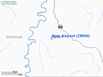
| From nearest city: | 15 nautical miles NW of Condon, OR |
| Location: | Gilliam County, OR |
| Magnetic Variation: | 19E (1985) |
Owner & Manager
| Ownership: | Privately owned |
| Owner: | Van Rietmann |
| Address: | Box 446
Condon, OR 97823 |
| Address: |
|
Airport Operations and Facilities
| Airport Use: | Private |
| Wind indicator: | Yes |
| Segmented Circle: | No |
| Control Tower: | No |
| Landing fee charge: | No |
| Sectional chart: | Seattle |
| Region: | ANM - Northwest Mountain |
| Boundary ARTCC: | ZSE - Seattle |
| Tie-in FSS: | MMV - Mc Minnville |
| FSS on Airport: | No |
| FSS Toll Free: | 1-800-WX-BRIEF |
Airport Services
| Airframe Repair: | NONE |
| Power Plant Repair: | NONE |
Runway Information
Runway E/W
| Dimension: | 2500 x 50 ft / 762.0 x 15.2 m |
| Surface: | DIRT, |
| |
Runway E |
Runway W |
| Traffic Pattern: | Left | Left |
|
Radio Navigation Aids
| ID |
Type |
Name |
Ch |
Freq |
Var |
Dist |
| LTJ | VOR/DME | Klickitat | 070X | 112.30 | 21E | 33.2 nm |
Remarks
Images and information placed above are from
http://www.airport-data.com/airport/OR46/
We thank them for the data!
|
|


