 |
|
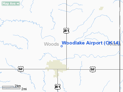
Location & QuickFacts
| FAA Information Effective: | 2008-09-25 |
| Airport Identifier: | OK14 |
| Airport Status: | Operational |
| Longitude/Latitude: | 098-39-27.8000W/36-50-06.8000N
-98.657722/36.835222 (Estimated) |
| Elevation: | 1420 ft / 432.82 m (Estimated) |
| Land: | 23 acres |
| From nearest city: | 3 nautical miles N of Alva, OK |
| Location: | Woods County, OK |
| Magnetic Variation: | () |
Owner & Manager
| Ownership: | Privately owned |
| Owner: | Max Mcdermott |
| Address: | 44550 Woodlake Dr
Alva, OK 73717 |
| Phone number: | 580-327-3500 |
| Manager: | Max Mcdermott |
| Address: | 44550 Woodlake Dr
Alva, OK 73717 |
| Phone number: | 580-327-4001 |
Airport Operations and Facilities
| Airport Use: | Private |
| Wind indicator: | Yes |
| Segmented Circle: | No |
| Control Tower: | No |
| Sectional chart: | Wichita |
| Region: | ASW - Southwest |
| Boundary ARTCC: | ZKC - Kansas City |
| Tie-in FSS: | MLC - Mc Alester |
| FSS Toll Free: | 1-800-WX-BRIEF |
Runway Information
Runway 17/35
| Dimension: | 1000 x 40 ft / 304.8 x 12.2 m |
| Surface: | TURF, |
| |
Runway 17 |
Runway 35 |
| Traffic Pattern: | Right | Left |
| Displaced threshold: | 0.00 ft | 200.00 ft |
| Obstruction: | 4 ft fence | 4 ft fence, 0.0 ft from runway |
|
Radio Navigation Aids
| ID |
Type |
Name |
Ch |
Freq |
Var |
Dist |
| AVK | NDB | Alva | | 203.00 | 08E | 3.4 nm |
| MDF | NDB | Mooreland/dcmsnd | | 284.00 | 08E | 33.2 nm |
| FAU | NDB | Fairview | | 246.00 | 07E | 34.2 nm |
| BFK | NDB | Buffalo | | 215.00 | 08E | 46.3 nm |
| OWU | NDB | West Woodward | | 329.00 | 08E | 48.2 nm |
| ANY | VORTAC | Anthony | 076X | 112.90 | 07E | 30.4 nm |
| END | VORTAC | Vance | 101X | 115.40 | 09E | 46.2 nm |
Remarks
- PRVDD ALVA REGIONAL ARPT MADE AWARE OF THIS PRIVATE USE ARPT.
Images and information placed above are from
http://www.airport-data.com/airport/OK14/
We thank them for the data!
|
|


