 |
|
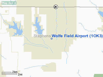
Location & QuickFacts
| FAA Information Effective: | 2008-09-25 |
| Airport Identifier: | 1OK3 |
| Airport Status: | Operational |
| Longitude/Latitude: | 097-48-50.9200W/34-34-33.8800N
-97.814144/34.576078 (Estimated) |
| Elevation: | 1194 ft / 363.93 m (Estimated) |
| Land: | 27 acres |
| From nearest city: | 4 nautical miles S of Bray, OK |
| Location: | Stephens County, OK |
| Magnetic Variation: | 06E (2000) |
Owner & Manager
| Ownership: | Privately owned |
| Owner: | Robert N. Wolfe |
| Address: | 7802 Parker St
Marlow, OK 73055 |
| Phone number: | 580-252-4233 |
| Manager: | Robert N. Wolfe |
| Address: | 7802 Parker St
Marlow, OK 73055 |
| Phone number: | 580-252-4233 |
Airport Operations and Facilities
| Airport Use: | Private |
| Wind indicator: | Yes |
| Segmented Circle: | No |
| Control Tower: | No |
| Sectional chart: | Dallas-ft Worth |
| Region: | ASW - Southwest |
| Boundary ARTCC: | ZFW - Fort Worth |
| Tie-in FSS: | MLC - Mc Alester |
| FSS Toll Free: | 1-800-WX-BRIEF |
Runway Information
Runway 17/35
| Dimension: | 2640 x 100 ft / 804.7 x 30.5 m |
| Surface: | TURF, Good Condition |
| |
Runway 17 |
Runway 35 |
| Traffic Pattern: | Left | Left |
| Obstruction: | 4 ft fence, 50.0 ft from runway | 4 ft fence, 50.0 ft from runway |
|
Radio Navigation Aids
| ID |
Type |
Name |
Ch |
Freq |
Var |
Dist |
| FSI | FAN MARKER | Trail | | | 09E | 31.6 nm |
| PFL | NDB | Post | | 308.00 | 08E | 29.2 nm |
| PVJ | NDB | Pauls Valley | | 384.00 | 06E | 30.1 nm |
| OFZ | NDB | Trail | | 388.00 | 09E | 31.6 nm |
| OLR | NDB | Chickasha | | 290.00 | 07E | 32.7 nm |
| AUV | NDB | Arbuckle | | 284.00 | 07E | 42.7 nm |
| OUN | NDB | Norman | | 260.00 | 07E | 43.8 nm |
| SHP | TACAN | Sheppard | 045X | | 10E | 48.9 nm |
| DUC | VOR/DME | Duncan | 047X | 111.00 | 09E | 12.6 nm |
| LAW | VOR/DME | Lawton | 031X | 109.40 | 09E | 30.0 nm |
| ADM | VORTAC | Ardmore | 114X | 116.70 | 06E | 38.8 nm |
| IRW | VORTAC | Will Rogers | 088X | 114.10 | 07E | 48.1 nm |
Images and information placed above are from
http://www.airport-data.com/airport/1OK3/
We thank them for the data!
| General Info
|
| Country |
United States
|
| State |
OKLAHOMA
|
| FAA ID |
1OK3
|
| Latitude |
34.576078
34° 34' 33.88" N
|
| Longitude |
-97.814144
097° 48' 50.92" W
|
| Elevation |
1194 feet
364 meters
|
| Magnetic Variation |
005° E (01/06)
|
| Operating Agency |
PRIVATE
|
We don't guarantee the information is fresh and accurate. The data may
be wrong or outdated.
For more up-to-date information please refer to other sources.
|
|


