 |
|
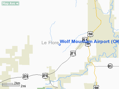
Location & QuickFacts
| FAA Information Effective: | 2008-09-25 |
| Airport Identifier: | OK59 |
| Airport Status: | Operational |
| Longitude/Latitude: | 094-42-15.8180W/35-01-20.3540N
-94.704394/35.022321 (Estimated) |
| Elevation: | 860 ft / 262.13 m (Estimated) |
| Land: | 0 acres |
| From nearest city: | 3 nautical miles NE of Poteau, OK |
| Location: | Le Flore County, OK |
| Magnetic Variation: | 05E (1985) |
Owner & Manager
| Ownership: | Privately owned |
| Owner: | Jim M. Johnson |
| Address: | Box C
Poteau, OK 74953 |
| Phone number: | 918-647-8656 |
| Manager: | Jim M. Johnson |
| Address: | Box C
Poteau, OK 74953 |
| Phone number: | 918-647-8656 |
Airport Operations and Facilities
| Airport Use: | Private |
| Wind indicator: | Yes |
| Segmented Circle: | No |
| Control Tower: | No |
| Sectional chart: | Memphis |
| Region: | ASW - Southwest |
| Boundary ARTCC: | ZME - Memphis |
| Tie-in FSS: | MLC - Mc Alester |
| FSS on Airport: | No |
| FSS Toll Free: | 1-800-WX-BRIEF |
Runway Information
Runway 06/24
| Dimension: | 2400 x 50 ft / 731.5 x 15.2 m |
| Surface: | TURF, |
| |
Runway 06 |
Runway 24 |
| Traffic Pattern: | Left | Left |
|
Radio Navigation Aids
| ID |
Type |
Name |
Ch |
Freq |
Var |
Dist |
| IQS | NDB | Sallisaw | | 520.00 | 05E | 23.0 nm |
| MEZ | NDB | Mena | | 242.00 | 04E | 37.5 nm |
| MKO | NDB | Muskogee | | 306.00 | 06E | 44.7 nm |
| PGO | VORTAC | Rich Mountain | 082X | 113.50 | 04E | 21.1 nm |
| FSM | VORTAC | Fort Smith | 041X | 110.40 | 07E | 30.6 nm |
Images and information placed above are from
http://www.airport-data.com/airport/OK59/
We thank them for the data!
| General Info
|
| Country |
United States
|
| State |
OKLAHOMA
|
| FAA ID |
OK59
|
| Latitude |
35-01-20.354N
|
| Longitude |
094-42-15.818W
|
| Elevation |
860 feet
|
| Near City |
POTEAU
|
We don't guarantee the information is fresh and accurate. The data may
be wrong or outdated.
For more up-to-date information please refer to other sources.
|
|


