 |
|
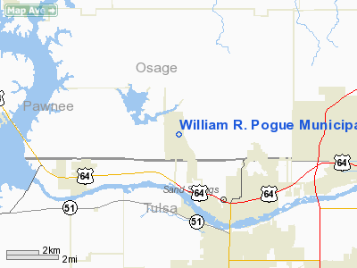
William R. Pogue Muni Airport |
Location & QuickFacts
| FAA Information Effective: | 2008-09-25 |
| Airport Identifier: | OWP |
| Airport Status: | Operational |
| Longitude/Latitude: | 096-09-06.6000W/36-10-31.0000N
-96.151833/36.175278 (Estimated) |
| Elevation: | 892 ft / 271.88 m (Surveyed) |
| Land: | 424 acres |
| From nearest city: | 3 nautical miles NW of Sand Springs, OK |
| Location: | Osage County, OK |
| Magnetic Variation: | 06E (1985) |
Owner & Manager
| Ownership: | Publicly owned |
| Owner: | City Of Sand Springs |
| Address: | City Hall, 100 E. Broadway
Sand Springs, OK 74063 |
| Phone number: | 918-246-2500 |
| Manager: | Ken Madison |
| Address: | 3200 N Airport Rd
Sand Springs, OK 74063 |
| Phone number: | 918-246-2605 |
Airport Operations and Facilities
| Airport Use: | Open to public |
| Wind indicator: | Yes |
| Segmented Circle: | Yes |
| Control Tower: | No |
| Lighting Schedule: | DUSK-DAWN |
| Beacon Color: | Clear-Green (lighted land airport) |
| Landing fee charge: | No |
| Sectional chart: | Kansas City |
| Region: | ASW - Southwest |
| Boundary ARTCC: | ZKC - Kansas City |
| Tie-in FSS: | MLC - Mc Alester |
| FSS on Airport: | No |
| FSS Toll Free: | 1-800-WX-BRIEF |
| NOTAMs Facility: | MLC (NOTAM-d service avaliable) |
| Federal Agreements: | NGY |
Airport Communications
| CTAF: | 122.700 |
| Unicom: | 122.700 |
Airport Services
| Fuel available: | 100LL |
| Airframe Repair: | MAJOR |
| Power Plant Repair: | MAJOR |
| Bottled Oxygen: | NONE |
| Bulk Oxygen: | NONE |
Runway Information
Runway 17/35
| Dimension: | 5799 x 100 ft / 1767.5 x 30.5 m |
| Surface: | ASPH, Good Condition |
| Surface Treatment: | Porous Friction Course |
| Weight Limit: | Single wheel: 30000 lbs.
Dual wheel: 58000 lbs. |
| Edge Lights: | Medium |
| |
Runway 17 |
Runway 35 |
| Longitude: | 096-09-09.4742W | 096-09-03.8018W |
| Latitude: | 36-10-59.5577N | 36-10-02.3955N |
| Elevation: | 889.00 ft | 890.00 ft |
| Alignment: | 127 | 127 |
| Traffic Pattern: | Left | Left |
| Markings: | Non-precision instrument, Good Condition | Non-precision instrument, Good Condition |
| Crossing Height: | 31.00 ft | 31.00 ft |
| VASI: | 4-light PAPI on left side | 4-light PAPI on left side |
| Visual Glide Angle: | 3.00° | 3.00° |
| Runway End Identifier: | | Yes |
|
Radio Navigation Aids
| ID |
Type |
Name |
Ch |
Freq |
Var |
Dist |
| OWP | NDB | William Pogue | | 362.00 | 06E | 0.2 nm |
| DW | NDB | Owaso | | 375.00 | 06E | 15.6 nm |
| TZO | NDB | Bristow | | 251.00 | 05E | 27.8 nm |
| CUH | NDB | Cushing | | 242.00 | 05E | 34.8 nm |
| CQB | NDB | Tilghman | | 396.00 | 06E | 42.4 nm |
| HET | NDB | Henryetta | | 267.00 | 04E | 46.8 nm |
| GGU | NDB | Prague | | 314.00 | 06E | 48.3 nm |
| MEE | VOR | Davis | | 108.60 | 06E | 49.0 nm |
| GNP | VOR/DME | Glenpool | 043X | 110.60 | 06E | 17.7 nm |
| OKM | VOR/DME | Okmulgee | 096X | 114.90 | 08E | 32.1 nm |
| BVO | VOR/DME | Bartlesville | 126X | 117.90 | 08E | 40.1 nm |
| SWO | VOR/DME | Stillwater | 021X | 108.40 | 07E | 45.2 nm |
| TUL | VORTAC | Tulsa | 091X | 114.40 | 08E | 17.7 nm |
| TUL | VOT | Tulsa Intl | | 109.00 | | 17.7 nm |
Remarks
- DEER INVOF ARPT.
- CALM WIND RY 17.
- HELICOPTER TRNG WEST TWY & WEST RAMP.
- TPA FIXED WING LGT ACFT 1009 FT AGL (1900 FT MSL); TURBOPROP & JET ACFT 1509 FT AGL (2400 FT MSL) AND HELICOPTERS 509 FT AGL (1400 FT MSL).
- PAEW ADJ WEST APRON & WEST TWY.
- TWY B LGTS OTS INDEFLY.
Images and information placed above are from
http://www.airport-data.com/airport/OWP/
We thank them for the data!
|
|


