 |
|
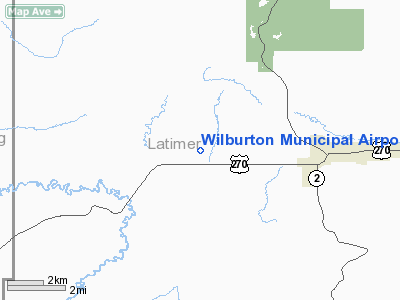
Location & QuickFacts
| FAA Information Effective: | 2008-09-25 |
| Airport Identifier: | H05 |
| Airport Status: | Operational |
| Longitude/Latitude: | 095-23-38.4100W/34-55-12.1100N
-95.394003/34.920031 (Estimated) |
| Elevation: | 670 ft / 204.22 m (Surveyed) |
| Land: | 80 acres |
| From nearest city: | 4 nautical miles W of Wilburton, OK |
| Location: | Latimer County, OK |
| Magnetic Variation: | 06E (1985) |
Owner & Manager
| Ownership: | Publicly owned |
| Owner: | City Of Wilburton |
| Address: | City Hall, 300 W. Main
Wilburton, OK 74578 |
| Phone number: | 918-465-5361 |
| Manager: | Stephen Brinlee
MAYOR. |
| Address: | City Hall, 300 W. Main
Wilburton, OK 74578 |
| Phone number: | 918-465-5631 |
Airport Operations and Facilities
| Airport Use: | Open to public |
| Wind indicator: | Yes |
| Segmented Circle: | Yes |
| Control Tower: | No |
| Lighting Schedule: | DUSK-DAWN |
| Beacon Color: | Clear-Green (lighted land airport) |
| Landing fee charge: | No |
| Sectional chart: | Dallas-ft Worth |
| Region: | ASW - Southwest |
| Boundary ARTCC: | ZFW - Fort Worth |
| Tie-in FSS: | MLC - Mc Alester |
| FSS on Airport: | No |
| FSS Toll Free: | 1-800-WX-BRIEF |
| NOTAMs Facility: | MLC (NOTAM-d service avaliable) |
| Federal Agreements: | NGY |
Airport Communications
Airport Services
| Bottled Oxygen: | NONE |
| Bulk Oxygen: | NONE |
Runway Information
Runway 17/35
| Dimension: | 3000 x 60 ft / 914.4 x 18.3 m |
| Surface: | ASPH, Good Condition |
| Weight Limit: | Single wheel: 2000 lbs. |
| |
Runway 17 |
Runway 35 |
| Longitude: | 095-23-38.4100W | 095-23-38.4100W |
| Latitude: | 34-55-26.9500N | 34-54-57.2800N |
| Alignment: | 127 | 127 |
| Traffic Pattern: | Left | Left |
| Markings: | Basic, Good Condition | Basic, Good Condition |
| Obstruction: | 45 ft trees, 654.0 ft from runway, 10:1 slope to clear | 45 ft trees, 795.0 ft from runway, 13:1 slope to clear |
|
Radio Navigation Aids
| ID |
Type |
Name |
Ch |
Freq |
Var |
Dist |
| MKO | NDB | Muskogee | | 306.00 | 06E | 40.9 nm |
| IQS | NDB | Sallisaw | | 520.00 | 05E | 41.2 nm |
| HET | NDB | Henryetta | | 267.00 | 04E | 42.1 nm |
| AEE | NDB | Antlers | | 391.00 | 05E | 45.6 nm |
| MEE | VOR | Davis | | 108.60 | 06E | 44.7 nm |
| MLC | VORTAC | Mc Alester | 057X | 112.00 | 08E | 19.6 nm |
| PGO | VORTAC | Rich Mountain | 082X | 113.50 | 04E | 41.3 nm |
Remarks
- DEER ON & INVOF RY.
- PARALLEL TWY CLSD INDEFLY.
Images and information placed above are from
http://www.airport-data.com/airport/H05/
We thank them for the data!
| General Info
|
| Country |
United States
|
| State |
OKLAHOMA
|
| FAA ID |
H05
|
| Latitude |
34-55-10.354N
|
| Longitude |
095-23-40.910W
|
| Elevation |
670 feet
|
| Near City |
WILBURTON
|
We don't guarantee the information is fresh and accurate. The data may
be wrong or outdated.
For more up-to-date information please refer to other sources.
|
|


