 |
|
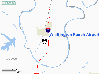
Whittington Ranch Airport |
Location & QuickFacts
| FAA Information Effective: | 2008-09-25 |
| Airport Identifier: | OK31 |
| Airport Status: | Operational |
| Longitude/Latitude: | 097-07-53.2500W/33-46-42.7500N
-97.131458/33.778542 (Estimated) |
| Elevation: | 845 ft / 257.56 m (Estimated) |
| Land: | 0 acres |
| From nearest city: | 1 nautical miles SE of Thackerville, OK |
| Location: | Love County, OK |
| Magnetic Variation: | () |
Owner & Manager
| Ownership: | Privately owned |
| Owner: | Charles Whittington |
| Address: | Rt 1 Box 1042
Thackerville, OK 73459 |
| Phone number: | 580-276-5941 |
| Manager: | Dale Whittington |
| Address: | Rt 1 Box 927
Thackerville, OK 73459 |
| Phone number: | 580-276-1135 |
Airport Operations and Facilities
| Airport Use: | Private |
| Control Tower: | No |
| Sectional chart: | Dallas-ft Worth |
| Region: | ASW - Southwest |
| Boundary ARTCC: | ZFW - Fort Worth |
| Tie-in FSS: | MLC - Mc Alester |
| FSS Toll Free: | 1-800-WX-BRIEF |
Runway Information
Runway 18/36
| Dimension: | 2000 x 50 ft / 609.6 x 15.2 m |
| Surface: | TURF, |
| |
Runway 18 |
Runway 36 |
| Traffic Pattern: | Left | Right |
|
Radio Navigation Aids
| ID |
Type |
Name |
Ch |
Freq |
Var |
Dist |
| GLE | NDB | Gainesville | | 330.00 | 06E | 4.9 nm |
| AUV | NDB | Arbuckle | | 284.00 | 07E | 22.4 nm |
| DNI | NDB | Denison | | 341.00 | 06E | 23.2 nm |
| GMZ | NDB | Grindstone Mountain | | 356.00 | 07E | 33.7 nm |
| DUA | NDB | Durant | | 359.00 | 05E | 37.8 nm |
| HJM | NDB | Rayburn | | 415.00 | 06E | 48.8 nm |
| URH | VOR/DME | Texoma | 090X | 114.30 | 05E | 38.2 nm |
| ADM | VORTAC | Ardmore | 114X | 116.70 | 06E | 26.1 nm |
| UKW | VORTAC | Bowie | 071X | 112.40 | 06E | 37.5 nm |
| BYP | VORTAC | Bonham | 093X | 114.60 | 06E | 47.2 nm |
Images and information placed above are from
http://www.airport-data.com/airport/OK31/
We thank them for the data!
|
|


