 |
|
Location & QuickFacts
| FAA Information Effective: | 2008-09-25 |
| Airport Identifier: | OL20 |
| Airport Status: | Operational |
| Longitude/Latitude: | 095-15-31.8580W/35-59-50.3580N
-95.258849/35.997322 (Estimated) |
| Elevation: | 568 ft / 173.13 m (Surveyed) |
| Land: | 0 acres |
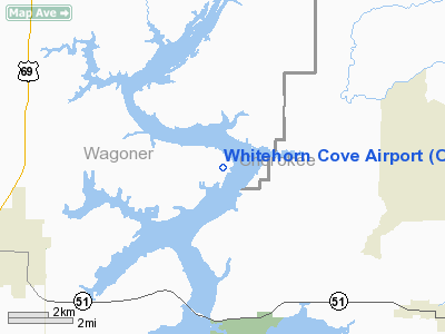
| From nearest city: | 6 nautical miles NE of Wagoner, OK |
| Location: | Wagoner County, OK |
| Magnetic Variation: | 06E (1985) |
Owner & Manager
| Ownership: | Privately owned |
| Owner: | Psb Corporation |
| Address: | Rt 1 Box 440
Wagoner, OK 74467 |
| Phone number: | 918-462-3311 |
| Manager: | Paul Bengels |
| Address: | Rt 1 Box 440
Wagoner, OK 74467 |
| Phone number: | 918-462-3311 |
Airport Operations and Facilities
| Airport Use: | Private |
| Wind indicator: | Yes |
| Segmented Circle: | No |
| Control Tower: | No |
| Sectional chart: | Albuquerque |
| Region: | ASW - Southwest |
| Boundary ARTCC: | ZME - Memphis |
| Tie-in FSS: | MLC - Mc Alester |
| FSS Toll Free: | 1-800-WX-BRIEF |
Runway Information
Runway 13/31
| Dimension: | 2000 x 100 ft / 609.6 x 30.5 m |
| Surface: | TURF, |
| |
Runway 13 |
Runway 31 |
| Traffic Pattern: | Left | Left |
| Obstruction: | 20 ft trees, 10.0 ft from runway | 20 ft trees, 10.0 ft from runway |
|
Runway 17/35
| Dimension: | 3000 x 100 ft / 914.4 x 30.5 m |
| Surface: | TURF, |
| |
Runway 17 |
Runway 35 |
| Traffic Pattern: | Left | Left |
| Obstruction: | 20 ft trees, 10.0 ft from runway | 20 ft trees, 10.0 ft from runway |
|
Radio Navigation Aids
| ID |
Type |
Name |
Ch |
Freq |
Var |
Dist |
| TQH | NDB | Tahlequah | | 215.00 | 05E | 13.0 nm |
| MKO | NDB | Muskogee | | 306.00 | 06E | 24.2 nm |
| DW | NDB | Owaso | | 375.00 | 06E | 35.2 nm |
| SLG | NDB | Siloam Springs | | 284.00 | 04E | 39.2 nm |
| IQS | NDB | Sallisaw | | 520.00 | 05E | 42.5 nm |
| OWP | NDB | William Pogue | | 362.00 | 06E | 44.8 nm |
| MEE | VOR | Davis | | 108.60 | 06E | 20.8 nm |
| OKM | VOR/DME | Okmulgee | 096X | 114.90 | 08E | 34.8 nm |
| GNP | VOR/DME | Glenpool | 043X | 110.60 | 06E | 34.8 nm |
| TUL | VORTAC | Tulsa | 091X | 114.40 | 08E | 28.4 nm |
| TUL | VOT | Tulsa Intl | | 109.00 | | 28.4 nm |
Images and information placed above are from
http://www.airport-data.com/airport/OL20/
We thank them for the data!
| General Info
|
| Country |
United States
|
| State |
OKLAHOMA
|
| FAA ID |
OL20
|
| Latitude |
35-59-50.358N
|
| Longitude |
095-15-31.858W
|
| Elevation |
568 feet
|
| Near City |
WAGONER
|
We don't guarantee the information is fresh and accurate. The data may
be wrong or outdated.
For more up-to-date information please refer to other sources.
|
|


