 |
|
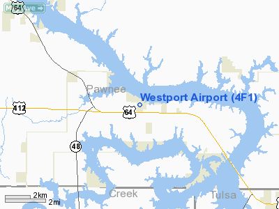
Location & QuickFacts
| FAA Information Effective: | 2008-09-25 |
| Airport Identifier: | 4F1 |
| Airport Status: | Operational |
| Longitude/Latitude: | 096-20-46.0530W/36-13-20.2760N
-96.346126/36.222299 (Estimated) |
| Elevation: | 900 ft / 274.32 m (Estimated) |
| Land: | 13 acres |
| From nearest city: | 2 nautical miles E of Westport, OK |
| Location: | Pawnee County, OK |
| Magnetic Variation: | 06E (1985) |
Owner & Manager
| Ownership: | Publicly owned |
| Owner: | Town Of Westport |
| Address: | Town Hall, Rr 3 Box 11
Cleveland, OK 74020 |
| Phone number: | 918-243-7454 |
| Manager: | Dan Swaim |
| Address: | Rr 3 Box 13-2
Cleveland, OK 74020 |
| Phone number: | 918-243-7792
ALT: 850-687-0153. |
Airport Operations and Facilities
| Airport Use: | Open to public |
| Wind indicator: | Yes |
| Segmented Circle: | No |
| Control Tower: | No |
| Lighting Schedule: | RDO-CTL
ACTVT MIRL RY 03/21 - CTAF. |
| Landing fee charge: | No |
| Sectional chart: | Kansas City |
| Region: | ASW - Southwest |
| Traffic Pattern Alt: | 600 ft |
| Boundary ARTCC: | ZKC - Kansas City |
| Tie-in FSS: | MLC - Mc Alester |
| FSS on Airport: | No |
| FSS Toll Free: | 1-800-WX-BRIEF |
| NOTAMs Facility: | MLC (NOTAM-d service avaliable) |
Airport Communications
Airport Services
| Airframe Repair: | NONE |
| Power Plant Repair: | NONE |
Runway Information
Runway 03/21
| Dimension: | 2900 x 42 ft / 883.9 x 12.8 m |
| Surface: | ASPH, Good Condition |
| Weight Limit: | Single wheel: 10000 lbs.
Dual wheel: 12500 lbs.
LIMITED BY ARPT OPERATOR TO 6000 LBS SINGLE WHEEL GEAR. |
| Edge Lights: | Medium |
| |
Runway 03 |
Runway 21 |
| Traffic Pattern: | Left | Left |
| Markings: | Basic, Good Condition | Basic, Good Condition |
|
Radio Navigation Aids
| ID |
Type |
Name |
Ch |
Freq |
Var |
Dist |
| OWP | NDB | William Pogue | | 362.00 | 06E | 9.8 nm |
| DW | NDB | Owaso | | 375.00 | 06E | 23.4 nm |
| TZO | NDB | Bristow | | 251.00 | 05E | 27.5 nm |
| CUH | NDB | Cushing | | 242.00 | 05E | 28.9 nm |
| CQB | NDB | Tilghman | | 396.00 | 06E | 37.8 nm |
| GGU | NDB | Prague | | 314.00 | 06E | 46.1 nm |
| GNP | VOR/DME | Glenpool | 043X | 110.60 | 06E | 25.8 nm |
| SWO | VOR/DME | Stillwater | 021X | 108.40 | 07E | 35.6 nm |
| OKM | VOR/DME | Okmulgee | 096X | 114.90 | 08E | 39.5 nm |
| BVO | VOR/DME | Bartlesville | 126X | 117.90 | 08E | 40.0 nm |
| TUL | VORTAC | Tulsa | 091X | 114.40 | 08E | 27.1 nm |
| TUL | VOT | Tulsa Intl | | 109.00 | | 27.1 nm |
Remarks
Images and information placed above are from
http://www.airport-data.com/airport/4F1/
We thank them for the data!
| General Info
|
| Country |
United States
|
| State |
OKLAHOMA
|
| FAA ID |
4F1
|
| Latitude |
36-13-20.276N
|
| Longitude |
096-20-46.053W
|
| Elevation |
900 feet
|
| Near City |
WESTPORT
|
We don't guarantee the information is fresh and accurate. The data may
be wrong or outdated.
For more up-to-date information please refer to other sources.
|
|


