 |
|
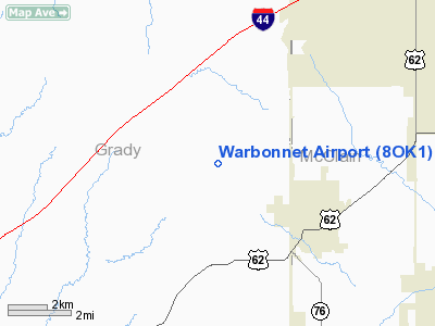
Location & QuickFacts
| FAA Information Effective: | 2008-09-25 |
| Airport Identifier: | 8OK1 |
| Airport Status: | Operational |
| Longitude/Latitude: | 097-42-39.0000W/35-10-06.0000N
-97.710833/35.168333 (Estimated) |
| Elevation: | 1335 ft / 406.91 m (Estimated) |
| Land: | 0 acres |
| From nearest city: | 3 nautical miles NW of Blanchard, OK |
| Location: | Grady County, OK |
| Magnetic Variation: | 07E (1990) |
Owner & Manager
| Ownership: | Privately owned |
| Owner: | S.c. Andrews |
| Address: | 1554 County St 2970
Blanchard, OK 73010 |
| Phone number: | 405-485-9264 |
| Manager: | S.c. Andrews |
| Address: | 1554 County St 2970
Blanchard, OK 73010 |
| Phone number: | 405-485-9264 |
Airport Operations and Facilities
| Airport Use: | Private |
| Segmented Circle: | No |
| Control Tower: | No |
| Sectional chart: | Dallas-ft Worth |
| Region: | ASW - Southwest |
| Boundary ARTCC: | ZFW - Fort Worth |
| Tie-in FSS: | MLC - Mc Alester |
| FSS on Airport: | No |
| FSS Toll Free: | 1-800-WX-BRIEF |
Runway Information
Runway 02/20
| Dimension: | 1700 x 60 ft / 518.2 x 18.3 m |
| Surface: | TURF, |
| |
Runway 02 |
Runway 20 |
| Traffic Pattern: | Left | Left |
|
Runway 04/22
| Dimension: | 600 x 40 ft / 182.9 x 12.2 m |
| Surface: | TURF, |
| |
Runway 04 |
Runway 22 |
| Traffic Pattern: | Left | Left |
|
Radio Navigation Aids
| ID |
Type |
Name |
Ch |
Freq |
Var |
Dist |
| FSI | FAN MARKER | Trail | | | 09E | 41.2 nm |
| OUN | NDB | Norman | | 260.00 | 07E | 12.8 nm |
| OLR | NDB | Chickasha | | 290.00 | 07E | 13.4 nm |
| OK | NDB | Tuloo | | 406.00 | 07E | 18.9 nm |
| RQO | NDB | El Reno | | 335.00 | 07E | 23.7 nm |
| PVJ | NDB | Pauls Valley | | 384.00 | 06E | 36.1 nm |
| OFZ | NDB | Trail | | 388.00 | 09E | 41.2 nm |
| LCY | NDB | Logan County | | 326.00 | 07E | 43.2 nm |
| PFL | NDB | Post | | 308.00 | 08E | 47.9 nm |
| TIK | TACAN | Tinker | 105X | | 07E | 22.9 nm |
| PWA | VOR/DME | Wiley Post | 081X | 113.40 | 08E | 22.1 nm |
| DUC | VOR/DME | Duncan | 047X | 111.00 | 09E | 48.2 nm |
| IRW | VORTAC | Will Rogers | 088X | 114.10 | 07E | 12.5 nm |
| IFI | VORTAC | Kingfisher | 094X | 114.70 | 09E | 40.9 nm |
| OKC | VOT | Oklahoma Will Rgs W | | 108.80 | | 14.6 nm |
Remarks
- PRVDD ALL RY LNDG THRS BE LCTD OR DSPLCD TO PRVD A 20:1 APCH SFC OVER ALL OBSTRUCTIONS.
Images and information placed above are from
http://www.airport-data.com/airport/8OK1/
We thank them for the data!
| General Info
|
| Country |
United States
|
| State |
OKLAHOMA
|
| FAA ID |
8OK1
|
| Latitude |
35-10-06.000N
|
| Longitude |
097-42-39.000W
|
| Elevation |
1335 feet
|
| Near City |
BLANCHARD
|
We don't guarantee the information is fresh and accurate. The data may
be wrong or outdated.
For more up-to-date information please refer to other sources.
|
|


