 |
|
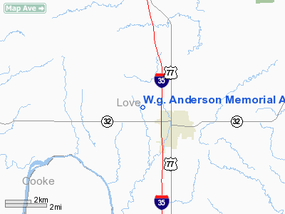
W.g. Anderson Memorial Airport |
Location & QuickFacts
| FAA Information Effective: | 2008-09-25 |
| Airport Identifier: | 74OK |
| Airport Status: | Operational |
| Longitude/Latitude: | 097-09-01.0470W/33-57-00.3600N
-97.150291/33.950100 (Estimated) |
| Elevation: | 825 ft / 251.46 m (Estimated) |
| Land: | 76 acres |
| From nearest city: | 1 nautical miles NW of Marietta, OK |
| Location: | Love County, OK |
| Magnetic Variation: | 07E (1985) |
Owner & Manager
| Ownership: | Privately owned |
| Owner: | Betty Anderson |
| Address: | Hc 73 Box 16
Marietta, OK 73448 |
| Phone number: | 405-276-5088 |
| Address: |
|
Airport Operations and Facilities
| Airport Use: | Private |
| Wind indicator: | Yes |
| Segmented Circle: | No |
| Control Tower: | No |
| Sectional chart: | Dallas-ft Worth |
| Region: | ASW - Southwest |
| Boundary ARTCC: | ZFW - Fort Worth |
| Tie-in FSS: | FTW - Fort Worth |
| FSS Phone: | 817-541-3474 |
| FSS Toll Free: | 1-800-WX-BRIEF |
Runway Information
Runway 17/35
| Dimension: | 2700 x 100 ft / 823.0 x 30.5 m |
| Surface: | TURF, |
| |
Runway 17 |
Runway 35 |
| Traffic Pattern: | Left | Left |
| Obstruction: | | 60 ft plines, 600.0 ft from runway |
|
Radio Navigation Aids
| ID |
Type |
Name |
Ch |
Freq |
Var |
Dist |
| AUV | NDB | Arbuckle | | 284.00 | 07E | 12.1 nm |
| GLE | NDB | Gainesville | | 330.00 | 06E | 14.1 nm |
| DNI | NDB | Denison | | 341.00 | 06E | 25.1 nm |
| GMZ | NDB | Grindstone Mountain | | 356.00 | 07E | 37.4 nm |
| DUA | NDB | Durant | | 359.00 | 05E | 37.4 nm |
| PVJ | NDB | Pauls Valley | | 384.00 | 06E | 46.2 nm |
| URH | VOR/DME | Texoma | 090X | 114.30 | 05E | 37.8 nm |
| DUC | VOR/DME | Duncan | 047X | 111.00 | 09E | 46.2 nm |
| ADM | VORTAC | Ardmore | 114X | 116.70 | 06E | 15.7 nm |
| UKW | VORTAC | Bowie | 071X | 112.40 | 06E | 41.8 nm |
Remarks
- PRVDD AGREEMENT IS MADE WITH LOVE CTY ARPT TO ESTABLISH COMPATIBLE TFC PTNS; THRESHOLDS BE DISPLACED TO PROVIDE 20:1 APCH SLOPES.
Images and information placed above are from
http://www.airport-data.com/airport/74OK/
We thank them for the data!
| General Info
|
| Country |
United States
|
| State |
OKLAHOMA
|
| FAA ID |
74OK
|
| Latitude |
33-57-00.360N
|
| Longitude |
097-09-01.047W
|
| Elevation |
825 feet
|
| Near City |
MARIETTA
|
We don't guarantee the information is fresh and accurate. The data may
be wrong or outdated.
For more up-to-date information please refer to other sources.
|
|


