 |
|
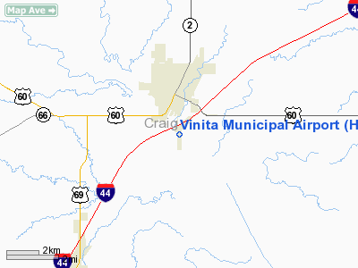
Location & QuickFacts
| FAA Information Effective: | 2008-09-25 |
| Airport Identifier: | H04 |
| Airport Status: | Operational |
| Longitude/Latitude: | 095-09-04.9000W/36-36-58.8650N
-95.151361/36.616351 (Estimated) |
| Elevation: | 696 ft / 212.14 m (Surveyed) |
| Land: | 57 acres |
| From nearest city: | 2 nautical miles SE of Vinita, OK |
| Location: | Craig County, OK |
| Magnetic Variation: | 05E (1985) |
Owner & Manager
| Ownership: | Publicly owned |
| Owner: | City Of Vinita |
| Address: | City Hall, Po Box 329
Vinita, OK 74301 |
| Phone number: | 918-256-6468 |
| Manager: | Bob Thornton
ARPT BOARD CHAIRMAN. |
| Address: | 1310 Churchill Road
Vinita, OK 74301 |
| Phone number: | 918-256-7708 |
Airport Operations and Facilities
| Airport Use: | Open to public |
| Wind indicator: | Yes |
| Segmented Circle: | Yes |
| Control Tower: | No |
| Lighting Schedule: | DUSK-DAWN
ACTVT MIRL RY 17/35 - 122.8. |
| Beacon Color: | Clear-Green (lighted land airport) |
| Landing fee charge: | No |
| Sectional chart: | Kansas City |
| Region: | ASW - Southwest |
| Traffic Pattern Alt: | 800 ft |
| Boundary ARTCC: | ZKC - Kansas City |
| Tie-in FSS: | MLC - Mc Alester |
| FSS on Airport: | No |
| FSS Toll Free: | 1-800-WX-BRIEF |
| NOTAMs Facility: | MLC (NOTAM-d service avaliable) |
| Federal Agreements: | NGY |
Airport Communications
Airport Services
| Bottled Oxygen: | NONE |
| Bulk Oxygen: | NONE |
Runway Information
Runway 17/35
| Dimension: | 3265 x 60 ft / 995.2 x 18.3 m |
| Surface: | ASPH, Good Condition |
| Edge Lights: | Medium |
| |
Runway 17 |
Runway 35 |
| Longitude: | 095-09-04.9000W | 095-09-04.9000W |
| Latitude: | 36-37-13.0290N | 36-36-44.7000N |
| Elevation: | 696.00 ft | 686.00 ft |
| Alignment: | 127 | 127 |
| Traffic Pattern: | Left | Left |
| Markings: | Basic, Fair Condition | Basic, Fair Condition |
| Displaced threshold: | 110.00 ft | 0.00 ft |
| Obstruction: | 40 ft trees, 600.0 ft from runway, 10:1 slope to clear
APCH SLOPE 17:1 TO DSPLCD THLD. | 50 ft trees, 1009.0 ft from runway, 16:1 slope to clear |
|
Radio Navigation Aids
| ID |
Type |
Name |
Ch |
Freq |
Var |
Dist |
| CFV | NDB | Coffeyville | | 212.00 | 05E | 35.1 nm |
| DW | NDB | Owaso | | 375.00 | 06E | 39.6 nm |
| SLG | NDB | Siloam Springs | | 284.00 | 04E | 41.1 nm |
| TQH | NDB | Tahlequah | | 215.00 | 05E | 42.1 nm |
| PPF | NDB | Parsons | | 258.00 | 06E | 46.7 nm |
| EOS | VOR/DME | Neosho | 120X | 117.30 | 07E | 37.1 nm |
| BVO | VOR/DME | Bartlesville | 126X | 117.90 | 08E | 43.8 nm |
| OSW | VORTAC | Oswego | 123X | 117.60 | 08E | 32.6 nm |
| TUL | VORTAC | Tulsa | 091X | 114.40 | 08E | 39.8 nm |
| TUL | VOT | Tulsa Intl | | 109.00 | | 39.8 nm |
Remarks
- ULTRALIGHT ACTVTY ON & INVOF ARPT.
- +17 FT INTERSTATE HWY 425 FT NORTH OF RY 17 AER.
Images and information placed above are from
http://www.airport-data.com/airport/H04/
We thank them for the data!
| General Info
|
| Country |
United States
|
| State |
OKLAHOMA
|
| FAA ID |
H04
|
| Latitude |
36-37-58.865N
|
| Longitude |
095-09-04.900W
|
| Elevation |
696 feet
|
| Near City |
VINITA
|
We don't guarantee the information is fresh and accurate. The data may
be wrong or outdated.
For more up-to-date information please refer to other sources.
|
|


