 |
|
Location & QuickFacts
| FAA Information Effective: | 2008-09-25 |
| Airport Identifier: | 5O1 |
| Airport Status: | Operational |
| Longitude/Latitude: | 099-18-11.3800W/36-08-30.1510N
-99.303161/36.141709 (Estimated) |
| Elevation: | 2268 ft / 691.29 m (Surveyed) |
| Land: | 32 acres |
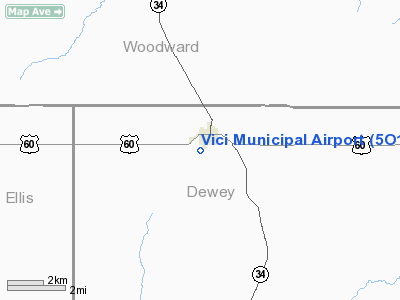
| From nearest city: | 1 nautical miles S of Vici, OK |
| Location: | Dewey County, OK |
| Magnetic Variation: | 08E (1985) |
Owner & Manager
| Ownership: | Publicly owned |
| Owner: | City Of Vici |
| Address: | Box 183
Vici, OK 73859 |
| Phone number: | 580-995-4442 |
| Manager: | David Trimble
MIKE JAMES, CITY SUPT. |
| Address: | Box 183
Vici, OK 73859 |
| Phone number: | 580-995-4231
ALTERNATE NR 580-995-3182. |
Airport Operations and Facilities
| Airport Use: | Open to public |
| Wind indicator: | Yes |
| Segmented Circle: | No |
| Control Tower: | No |
| Lighting Schedule: | DUSK-DAWN |
| Landing fee charge: | No |
| Sectional chart: | Wichita |
| Region: | ASW - Southwest |
| Boundary ARTCC: | ZKC - Kansas City |
| Tie-in FSS: | MLC - Mc Alester |
| FSS on Airport: | No |
| FSS Toll Free: | 1-800-WX-BRIEF |
| NOTAMs Facility: | MLC (NOTAM-d service avaliable) |
Airport Communications
Airport Services
| Airframe Repair: | NONE |
| Power Plant Repair: | NONE |
| Bottled Oxygen: | NONE |
| Bulk Oxygen: | NONE |
Runway Information
Runway 16/34
| Dimension: | 2565 x 50 ft / 781.8 x 15.2 m |
| Surface: | ASPH, Good Condition |
| Weight Limit: | Single wheel: 8000 lbs. |
| Edge Lights: | Low |
| |
Runway 16 |
Runway 34 |
| Traffic Pattern: | Left | Left |
| Obstruction: | 21 ft tree, 480.0 ft from runway, 100 ft left of centerline, 13:1 slope to clear
15 FT ROAD AT 48 FT FM THLD; +2 FT FENCE 18 FT FM THLD; +10 FT STREET SIGNS 82 FT FM THLD. | , 50:1 slope to clear |
|
Radio Navigation Aids
| ID |
Type |
Name |
Ch |
Freq |
Var |
Dist |
| OWU | NDB | West Woodward | | 329.00 | 08E | 20.6 nm |
| MDF | NDB | Mooreland/dcmsnd | | 284.00 | 08E | 21.4 nm |
| CLK | NDB | Clinton | | 320.00 | 07E | 40.4 nm |
| FAU | NDB | Fairview | | 246.00 | 07E | 40.9 nm |
| BZ | NDB | Fossi | | 393.00 | 08E | 41.8 nm |
| EZY | NDB | Elk City | | 241.00 | 08E | 43.3 nm |
| JWG | NDB | Watonga | | 359.00 | 07E | 45.9 nm |
| BFK | NDB | Buffalo | | 215.00 | 08E | 46.0 nm |
| OJA | NDB | Weatherford | | 272.00 | 07E | 48.0 nm |
| AVK | NDB | Alva | | 203.00 | 08E | 49.0 nm |
| GAG | VORTAC | Gage | 103X | 115.60 | 10E | 30.5 nm |
Remarks
- 145 FT GRAIN ELEVATOR 3/4 MI NE.
- VALLEY 10 FT FM RY 34 THLD.
Images and information placed above are from
http://www.airport-data.com/airport/5O1/
We thank them for the data!
| General Info
|
| Country |
United States
|
| State |
OKLAHOMA
|
| FAA ID |
5O1
|
| Latitude |
36-08-30.151N
|
| Longitude |
099-18-11.380W
|
| Elevation |
2268 feet
|
| Near City |
VICI
|
We don't guarantee the information is fresh and accurate. The data may
be wrong or outdated.
For more up-to-date information please refer to other sources.
|
|


