 |
|
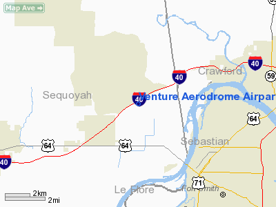
Venture Aerodrome Airpark Nr 2 Ultralight Airport |
Location & QuickFacts
| FAA Information Effective: | 2008-09-25 |
| Airport Identifier: | OK27 |
| Airport Status: | Operational |
| Longitude/Latitude: | 094-28-29.7770W/35-26-08.3250N
-94.474938/35.435646 (Estimated) |
| Elevation: | 450 ft / 137.16 m (Estimated) |
| Land: | 15 acres |
| From nearest city: | 1 nautical miles S of Roland, OK |
| Location: | Sequoyah County, OK |
| Magnetic Variation: | 05E (1985) |
Owner & Manager
| Ownership: | Privately owned |
| Owner: | William Jetton |
| Address: | 109000 South 4800 Rd
Roland, OK 74954 |
| Phone number: | 918-427-6490 |
| Manager: | William Jetton |
| Address: | 109000 South 4800 Rd
Roland, OK 74954 |
| Phone number: | 918-427-6490 |
Airport Operations and Facilities
| Airport Use: | Private |
| Wind indicator: | Yes |
| Segmented Circle: | No |
| Control Tower: | No |
| Sectional chart: | Memphis |
| Region: | ASW - Southwest |
| Boundary ARTCC: | ZME - Memphis |
| Tie-in FSS: | MLC - Mc Alester |
| FSS Toll Free: | 1-800-WX-BRIEF |
Runway Information
Runway 06/24
| Dimension: | 2000 x 60 ft / 609.6 x 18.3 m |
| Surface: | TURF, |
| |
Runway 06 |
Runway 24 |
| Traffic Pattern: | Left | Left |
| Obstruction: | | 40 ft pline, 200.0 ft from runway |
|
Radio Navigation Aids
| ID |
Type |
Name |
Ch |
Freq |
Var |
Dist |
| IQS | NDB | Sallisaw | | 520.00 | 05E | 15.8 nm |
| TQH | NDB | Tahlequah | | 215.00 | 05E | 39.3 nm |
| MKO | NDB | Muskogee | | 306.00 | 06E | 40.9 nm |
| SLG | NDB | Siloam Springs | | 284.00 | 04E | 45.3 nm |
| MEE | VOR | Davis | | 108.60 | 06E | 45.8 nm |
| DAK | VOR/DME | Drake | 025X | 108.80 | 07E | 38.9 nm |
| FSM | VORTAC | Fort Smith | 041X | 110.40 | 07E | 10.4 nm |
| PGO | VORTAC | Rich Mountain | 082X | 113.50 | 04E | 45.9 nm |
Images and information placed above are from
http://www.airport-data.com/airport/OK27/
We thank them for the data!
| General Info
|
| Country |
United States
|
| State |
OKLAHOMA
|
| FAA ID |
OK27
|
| Latitude |
35-26-08.325N
|
| Longitude |
094-28-29.777W
|
| Elevation |
450 feet
|
| Near City |
ROLAND
|
We don't guarantee the information is fresh and accurate. The data may
be wrong or outdated.
For more up-to-date information please refer to other sources.
|
|


