 |
|
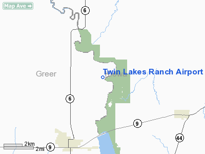
Location & QuickFacts
| FAA Information Effective: | 2008-09-25 |
| Airport Identifier: | 81OK |
| Airport Status: | Operational |
| Longitude/Latitude: | 099-20-22.0000W/35-01-35.0000N
-99.339444/35.026389 (Estimated) |
| Elevation: | 1630 ft / 496.82 m (Estimated) |
| Land: | 0 acres |
| From nearest city: | 7 nautical miles NN of Granite, OK |
| Location: | Greer County, OK |
| Magnetic Variation: | 07E (1995) |
Owner & Manager
| Ownership: | Privately owned |
| Owner: | Robert W Wetsel |
| Address: | 30397 North County Rd 2040
Granite, OK 73547 |
| Phone number: | 580-535-4349 |
| Manager: | Robert W Wetsel |
| Address: | 30397 North County Rd 2040
Granite, OK 73547 |
| Phone number: | 580-535-4349 |
Airport Operations and Facilities
| Airport Use: | Private |
| Segmented Circle: | No |
| Control Tower: | No |
| Sectional chart: | Dallas-ft Worth |
| Region: | ASW - Southwest |
| Boundary ARTCC: | ZFW - Fort Worth |
| Tie-in FSS: | MLC - Mc Alester |
| FSS on Airport: | No |
| FSS Toll Free: | 1-800-WX-BRIEF |
Runway Information
Runway 17/35
| Dimension: | 2200 x 35 ft / 670.6 x 10.7 m |
| Surface: | TURF, Good Condition |
| |
Runway 17 |
Runway 35 |
| Traffic Pattern: | Left | Left |
| Obstruction: | 5 ft fence, 30.0 ft from runway | 50 ft trees, 130.0 ft from runway |
|
Radio Navigation Aids
| ID |
Type |
Name |
Ch |
Freq |
Var |
Dist |
| FSI | FAN MARKER | Trail | | | 09E | 48.5 nm |
| EZY | NDB | Elk City | | 241.00 | 08E | 24.2 nm |
| BZ | NDB | Fossi | | 393.00 | 08E | 26.4 nm |
| CLK | NDB | Clinton | | 320.00 | 07E | 36.7 nm |
| OJA | NDB | Weatherford | | 272.00 | 07E | 44.6 nm |
| VRT | NDB | Wilbarger | | 230.00 | 08E | 48.2 nm |
| OFZ | NDB | Trail | | 388.00 | 09E | 48.5 nm |
| BFV | VORTAC | Burns Flat | 037X | 110.00 | 08E | 14.3 nm |
| HBR | VORTAC | Hobart | 055X | 111.80 | 10E | 16.7 nm |
| LTS | VORTAC | Altus | 035X | 109.80 | 08E | 22.1 nm |
| SYO | VORTAC | Sayre | 099X | 115.20 | 10E | 24.1 nm |
Images and information placed above are from
http://www.airport-data.com/airport/81OK/
We thank them for the data!
| General Info
|
| Country |
United States
|
| State |
OKLAHOMA
|
| FAA ID |
81OK
|
| Latitude |
35-01-35.000N
|
| Longitude |
099-20-22.000W
|
| Elevation |
1630 feet
|
| Near City |
GRANITE
|
We don't guarantee the information is fresh and accurate. The data may
be wrong or outdated.
For more up-to-date information please refer to other sources.
|
|


