 |
|
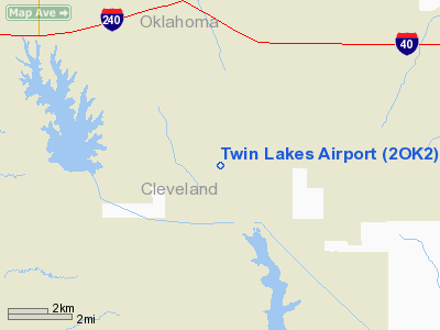
Location & QuickFacts
| FAA Information Effective: | 2008-09-25 |
| Airport Identifier: | 2OK2 |
| Airport Status: | Operational |
| Longitude/Latitude: | 097-16-11.1080W/35-19-45.2390N
-97.269752/35.329233 (Estimated) |
| Elevation: | 1199 ft / 365.46 m (Estimated) |
| Land: | 34 acres |
| From nearest city: | 10 nautical miles SE of Midwest City, OK |
| Location: | Cleveland County, OK |
| Magnetic Variation: | 07E (1985) |
Owner & Manager
| Ownership: | Privately owned |
| Owner: | Pilots Haven Airport Inc |
| Address: | 14111 Sky Harbor Way
Newalla, OK 74857 |
| Phone number: | 405-794-1319 |
| Manager: | Ervin Sharpe, President |
| Address: | 14111 Sky Harbor Way
Newalla, OK 74857 |
| Phone number: | 405-794-1319 |
Airport Operations and Facilities
| Airport Use: | Private |
| Wind indicator: | Yes |
| Segmented Circle: | No |
| Control Tower: | No |
| Lighting Schedule: | RDO-CTL
ACTVT LIRL RY N/S - 122.7. |
| Landing fee charge: | No |
| Sectional chart: | Dallas-ft Worth |
| Region: | ASW - Southwest |
| Boundary ARTCC: | ZFW - Fort Worth |
| Tie-in FSS: | MLC - Mc Alester |
| FSS on Airport: | No |
| FSS Toll Free: | 1-800-WX-BRIEF |
Airport Communications
Airport Services
| Airframe Repair: | NONE |
| Power Plant Repair: | NONE |
Runway Information
Runway N/S
| Dimension: | 2702 x 30 ft / 823.6 x 9.1 m |
| Surface: | CONC, |
| Edge Lights: | Low |
| |
Runway N |
Runway S |
| Traffic Pattern: | Right | Left |
| Obstruction: | 300 ft pline, 4000.0 ft from runway | |
|
Radio Navigation Aids
| ID |
Type |
Name |
Ch |
Freq |
Var |
Dist |
| OUN | NDB | Norman | | 260.00 | 07E | 11.0 nm |
| OK | NDB | Tuloo | | 406.00 | 07E | 18.5 nm |
| GGU | NDB | Prague | | 314.00 | 06E | 29.3 nm |
| SRE | NDB | Seminole | | 278.00 | 06E | 29.4 nm |
| LCY | NDB | Logan County | | 326.00 | 07E | 31.8 nm |
| CQB | NDB | Tilghman | | 396.00 | 06E | 32.3 nm |
| PVJ | NDB | Pauls Valley | | 384.00 | 06E | 37.0 nm |
| OLR | NDB | Chickasha | | 290.00 | 07E | 37.0 nm |
| RQO | NDB | El Reno | | 335.00 | 07E | 37.3 nm |
| CUH | NDB | Cushing | | 242.00 | 05E | 41.5 nm |
| HDL | NDB | Holdenville | | 411.00 | 06E | 44.5 nm |
| TZO | NDB | Bristow | | 251.00 | 05E | 49.1 nm |
| TIK | TACAN | Tinker | 105X | | 07E | 8.4 nm |
| PWA | VOR/DME | Wiley Post | 081X | 113.40 | 08E | 22.2 nm |
| ADH | VOR/DME | Ada | 125X | 117.80 | 06E | 43.3 nm |
| IRW | VORTAC | Will Rogers | 088X | 114.10 | 07E | 16.7 nm |
| IFI | VORTAC | Kingfisher | 094X | 114.70 | 09E | 45.9 nm |
| OKC | VOT | Oklahoma Will Rgs W | | 108.80 | | 16.6 nm |
Remarks
- SHARP DROP OFF AT EACH END OF RWY.
- HIGH LINE AT RIGHT ANGLE TO RWY-APRX 3/4MI FM S END OF RWY.
Images and information placed above are from
http://www.airport-data.com/airport/2OK2/
We thank them for the data!
| General Info
|
| Country |
United States
|
| State |
OKLAHOMA
|
| FAA ID |
2OK2
|
| Latitude |
35-19-45.239N
|
| Longitude |
097-16-11.108W
|
| Elevation |
1199 feet
|
| Near City |
MIDWEST CITY
|
We don't guarantee the information is fresh and accurate. The data may
be wrong or outdated.
For more up-to-date information please refer to other sources.
|
|


