 |
|
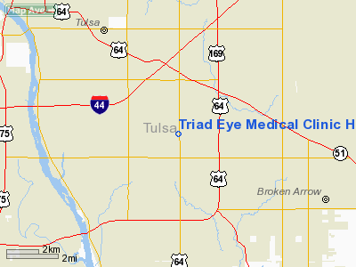
Triad Eye Medical Clinic Heliport |
Location & QuickFacts
| FAA Information Effective: | 2008-09-25 |
| Airport Identifier: | 21OK |
| Airport Status: | Operational |
| Longitude/Latitude: | 095-53-13.9800W/36-04-27.3700N
-95.887217/36.074269 (Estimated) |
| Elevation: | 725 ft / 220.98 m (Estimated) |
| Land: | 0 acres |
| From nearest city: | 8 nautical miles S of Tulsa, OK |
| Location: | Tulsa County, OK |
| Magnetic Variation: | 05E (1995) |
Owner & Manager
| Ownership: | Privately owned |
| Owner: | Marc L Abel, D.o. |
| Address: | 6140 South Memorial Drive
Tulsa, OK 74133 |
| Phone number: | 918-252-2020 |
| Manager: | Marc L Abel, D.o. |
| Address: | 6140 South Memorial Drive
Tulsa, OK 74133 |
| Phone number: | 918-252-2020 |
Airport Operations and Facilities
| Airport Use: | Private
MEDICAL. |
| Segmented Circle: | No |
| Control Tower: | No |
| Sectional chart: | Kansas City |
| Region: | ASW - Southwest |
| Boundary ARTCC: | ZKC - Kansas City |
| Tie-in FSS: | MLC - Mc Alester |
| FSS on Airport: | No |
| FSS Toll Free: | 1-800-WX-BRIEF |
Runway Information
Helipad H1
| Dimension: | 38 x 30 ft / 11.6 x 9.1 m
ROOFTOP. |
| Surface: | MATS, |
| |
Runway H1 |
Runway |
| Traffic Pattern: | Left | Left |
|
Radio Navigation Aids
| ID |
Type |
Name |
Ch |
Freq |
Var |
Dist |
| DW | NDB | Owaso | | 375.00 | 06E | 14.0 nm |
| OWP | NDB | William Pogue | | 362.00 | 06E | 14.3 nm |
| TZO | NDB | Bristow | | 251.00 | 05E | 31.9 nm |
| HET | NDB | Henryetta | | 267.00 | 04E | 40.7 nm |
| MKO | NDB | Muskogee | | 306.00 | 06E | 41.1 nm |
| TQH | NDB | Tahlequah | | 215.00 | 05E | 43.8 nm |
| CUH | NDB | Cushing | | 242.00 | 05E | 44.6 nm |
| MEE | VOR | Davis | | 108.60 | 06E | 35.4 nm |
| GNP | VOR/DME | Glenpool | 043X | 110.60 | 06E | 10.0 nm |
| OKM | VOR/DME | Okmulgee | 096X | 114.90 | 08E | 22.9 nm |
| BVO | VOR/DME | Bartlesville | 126X | 117.90 | 08E | 46.1 nm |
| TUL | VORTAC | Tulsa | 091X | 114.40 | 08E | 8.8 nm |
| TUL | VOT | Tulsa Intl | | 109.00 | | 8.8 nm |
Images and information placed above are from
http://www.airport-data.com/airport/21OK/
We thank them for the data!
| General Info
|
| Country |
United States
|
| State |
OKLAHOMA
|
| FAA ID |
21OK
|
| Latitude |
36-04-27.370N
|
| Longitude |
095-53-13.980W
|
| Elevation |
725 feet
|
| Near City |
TULSA
|
We don't guarantee the information is fresh and accurate. The data may
be wrong or outdated.
For more up-to-date information please refer to other sources.
|
|


