 |
|
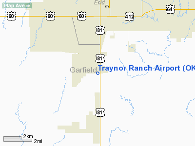
Location & QuickFacts
| FAA Information Effective: | 2008-09-25 |
| Airport Identifier: | OK50 |
| Airport Status: | Operational |
| Longitude/Latitude: | 097-53-35.0000W/36-19-57.0000N
-97.893056/36.332500 (Estimated) |
| Elevation: | 1220 ft / 371.86 m (Estimated) |
| Land: | 0 acres |
| From nearest city: | 3 nautical miles NE of Waukomis, OK |
| Location: | Garfield County, OK |
| Magnetic Variation: | 07E (1985) |
Owner & Manager
| Ownership: | Privately owned |
| Owner: | George L. Traynor |
| Address: | 709 W. Phillips Ave
Enid, OK 73701 |
| Phone number: | 580-233-3609 |
| Manager: | George L. Traynor |
| Address: | 709 W. Phillips Ave
Enid, OK 73701 |
| Phone number: | 580-233-3609 |
Airport Operations and Facilities
| Airport Use: | Private |
| Wind indicator: | Yes |
| Segmented Circle: | No |
| Control Tower: | No |
| Landing fee charge: | No |
| Sectional chart: | Wichita |
| Region: | ASW - Southwest |
| Boundary ARTCC: | ZKC - Kansas City |
| Tie-in FSS: | MLC - Mc Alester |
| FSS on Airport: | No |
| FSS Toll Free: | 1-800-WX-BRIEF |
Airport Services
| Fuel available: | 100LL |
| Airframe Repair: | NONE |
| Power Plant Repair: | NONE |
Runway Information
Runway 17/35
| Dimension: | 2500 x 100 ft / 762.0 x 30.5 m |
| Surface: | TURF, |
| |
Runway 17 |
Runway 35 |
| Traffic Pattern: | Left | Right |
|
Radio Navigation Aids
| ID |
Type |
Name |
Ch |
Freq |
Var |
Dist |
| FAU | NDB | Fairview | | 246.00 | 07E | 28.5 nm |
| LCY | NDB | Logan County | | 326.00 | 07E | 37.3 nm |
| JWG | NDB | Watonga | | 359.00 | 07E | 38.3 nm |
| AVK | NDB | Alva | | 203.00 | 08E | 46.2 nm |
| PN | NDB | Ponca | | 515.00 | 05E | 48.4 nm |
| ODG | VOR/DME | Woodring | 027X | 109.00 | 08E | 5.7 nm |
| SWO | VOR/DME | Stillwater | 021X | 108.40 | 07E | 39.9 nm |
| PWA | VOR/DME | Wiley Post | 081X | 113.40 | 08E | 49.5 nm |
| END | VORTAC | Vance | 101X | 115.40 | 09E | 1.5 nm |
| IFI | VORTAC | Kingfisher | 094X | 114.70 | 09E | 32.1 nm |
| PER | VORTAC | Pioneer | 079X | 113.20 | 06E | 43.3 nm |
Remarks
- PSNAL USE ONLY. ACFT TO REMAIN E OF HWY 81 BTN ENID & BISON & BELOW 1900' MSL WHILE IN VANCE TFC AREA. OWNER TO COORD INGRESS/EGRESS W/VANCE.
Images and information placed above are from
http://www.airport-data.com/airport/OK50/
We thank them for the data!
| General Info
|
| Country |
United States
|
| State |
OKLAHOMA
|
| FAA ID |
OK50
|
| Latitude |
36-19-57.000N
|
| Longitude |
097-53-35.000W
|
| Elevation |
1220 feet
|
| Near City |
WAUKOMIS
|
We don't guarantee the information is fresh and accurate. The data may
be wrong or outdated.
For more up-to-date information please refer to other sources.
|
|


