 |
|
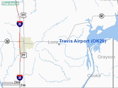
Location & QuickFacts
| FAA Information Effective: | 2008-09-25 |
| Airport Identifier: | OK29 |
| Airport Status: | Operational |
| Longitude/Latitude: | 097-03-16.0370W/33-56-09.3620N
-97.054455/33.935934 (Estimated) |
| Elevation: | 862 ft / 262.74 m (Estimated) |
| Land: | 0 acres |
| From nearest city: | 3 nautical miles S of Marietta, OK |
| Location: | Love County, OK |
| Magnetic Variation: | 07E (1985) |
Owner & Manager
| Ownership: | Privately owned |
| Owner: | Robert E. Travis |
| Address: | Hc 67 Box 25
Marietta, OK 93448 |
| Phone number: | 405-276-9267 |
| Manager: | Robert E. Travis |
| Address: | Hc 67 Box 25
Marietta, OK 93448 |
| Phone number: | 405-276-9267 |
Airport Operations and Facilities
| Airport Use: | Private |
| Wind indicator: | Yes |
| Segmented Circle: | No |
| Control Tower: | No |
| Sectional chart: | Dallas-ft Worth |
| Region: | ASW - Southwest |
| Boundary ARTCC: | ZFW - Fort Worth |
| Tie-in FSS: | MLC - Mc Alester |
| FSS Toll Free: | 1-800-WX-BRIEF |
Runway Information
Runway 09/27
| Dimension: | 1750 x 60 ft / 533.4 x 18.3 m |
| Surface: | TURF, |
| |
Runway 09 |
Runway 27 |
| Traffic Pattern: | Left | Left |
| Markings: | Nonstandard, | Nonstandard, |
|
Runway 16/34
| Dimension: | 2300 x 60 ft / 701.0 x 18.3 m |
| Surface: | TURF, |
| |
Runway 16 |
Runway 34 |
| Traffic Pattern: | Left | Left |
| Markings: | Nonstandard,
16/34 & 09/27 RWYS OUTLINE MKD BY TIRES. | Nonstandard, |
| Obstruction: | 40 ft pline, 400.0 ft from runway | |
|
Radio Navigation Aids
| ID |
Type |
Name |
Ch |
Freq |
Var |
Dist |
| AUV | NDB | Arbuckle | | 284.00 | 07E | 13.4 nm |
| GLE | NDB | Gainesville | | 330.00 | 06E | 14.9 nm |
| DNI | NDB | Denison | | 341.00 | 06E | 20.3 nm |
| DUA | NDB | Durant | | 359.00 | 05E | 32.6 nm |
| GMZ | NDB | Grindstone Mountain | | 356.00 | 07E | 41.0 nm |
| PVJ | NDB | Pauls Valley | | 384.00 | 06E | 47.6 nm |
| HJM | NDB | Rayburn | | 415.00 | 06E | 48.0 nm |
| URH | VOR/DME | Texoma | 090X | 114.30 | 05E | 33.0 nm |
| ADM | VORTAC | Ardmore | 114X | 116.70 | 06E | 17.5 nm |
| UKW | VORTAC | Bowie | 071X | 112.40 | 06E | 45.2 nm |
| BYP | VORTAC | Bonham | 093X | 114.60 | 06E | 47.5 nm |
Remarks
Images and information placed above are from
http://www.airport-data.com/airport/OK29/
We thank them for the data!
| General Info
|
| Country |
United States
|
| State |
OKLAHOMA
|
| FAA ID |
OK29
|
| Latitude |
33-56-09.362N
|
| Longitude |
097-03-16.037W
|
| Elevation |
862 feet
|
| Near City |
MARIETTA
|
We don't guarantee the information is fresh and accurate. The data may
be wrong or outdated.
For more up-to-date information please refer to other sources.
|
|


