 |
|
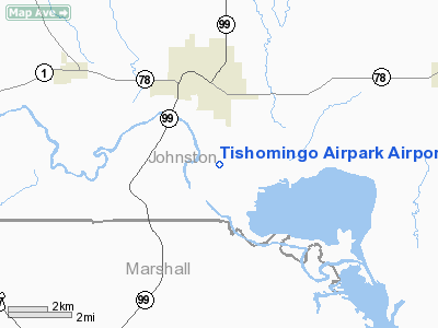
Tishomingo Airpark Airport |
Location & QuickFacts
| FAA Information Effective: | 2008-09-25 |
| Airport Identifier: | 0F9 |
| Airport Status: | Operational |
| Longitude/Latitude: | 096-40-28.2000W/34-11-54.6000N
-96.674500/34.198500 (Estimated) |
| Elevation: | 647 ft / 197.21 m (Estimated) |
| Land: | 75 acres |
| From nearest city: | 2 nautical miles S of Tishomingo, OK |
| Location: | Johnston County, OK |
| Magnetic Variation: | 06E (1985) |
Owner & Manager
| Ownership: | Publicly owned |
| Owner: | City Of Tishomingo |
| Address: | 202 S Capitol
Tishomingo, OK 73460 |
| Phone number: | 580-371-2369 |
| Manager: | Jack Yates
CITY MANAGER. |
| Address: | 202 S. Capitol
Tishomingo, OK 73460 |
| Phone number: | 580-371-2369 |
Airport Operations and Facilities
| Airport Use: | Open to public |
| Wind indicator: | Yes |
| Segmented Circle: | No |
| Control Tower: | No |
| Lighting Schedule: | DUSK-DAWN |
| Beacon Color: | Clear-Green (lighted land airport)
ROTG BCN OTS INDEFLY. |
| Landing fee charge: | No |
| Sectional chart: | Dallas-ft Worth |
| Region: | ASW - Southwest |
| Boundary ARTCC: | ZFW - Fort Worth |
| Tie-in FSS: | MLC - Mc Alester |
| FSS on Airport: | No |
| FSS Toll Free: | 1-800-WX-BRIEF |
| NOTAMs Facility: | MLC (NOTAM-d service avaliable) |
| Federal Agreements: | NGY |
Airport Communications
Airport Services
| Airframe Repair: | NONE |
| Power Plant Repair: | NONE |
| Bottled Oxygen: | NONE |
| Bulk Oxygen: | NONE |
Runway Information
Runway 17/35
| Dimension: | 3100 x 50 ft / 944.9 x 15.2 m |
| Surface: | ASPH, Poor Condition
SEVERE CRACKING & GRASS ENCROACHMENT. |
| Weight Limit: | Single wheel: 12000 lbs. |
| Edge Lights: | Medium
MIRL OTS INDEFLY. |
| |
Runway 17 |
Runway 35 |
| Longitude: | 096-40-28.0000W | 096-40-28.3000W |
| Latitude: | 34-12-09.9200N | 34-11-39.2600N |
| Traffic Pattern: | Left | Left |
| Markings: | Basic, Poor Condition
MARKINGS FADED SEVERELY. | Basic, Poor Condition
MARKINGS FADED SEVERELY. |
| Obstruction: | 60 ft trees, 300.0 ft from runway, 1:1 slope to clear | 42 ft trees, 270.0 ft from runway, 1:1 slope to clear |
|
Radio Navigation Aids
| ID |
Type |
Name |
Ch |
Freq |
Var |
Dist |
| DUA | NDB | Durant | | 359.00 | 05E | 20.6 nm |
| DNI | NDB | Denison | | 341.00 | 06E | 22.5 nm |
| AUV | NDB | Arbuckle | | 284.00 | 07E | 22.6 nm |
| GLE | NDB | Gainesville | | 330.00 | 06E | 38.9 nm |
| PVJ | NDB | Pauls Valley | | 384.00 | 06E | 41.5 nm |
| HJM | NDB | Rayburn | | 415.00 | 06E | 43.0 nm |
| URH | VOR/DME | Texoma | 090X | 114.30 | 05E | 20.8 nm |
| ADH | VOR/DME | Ada | 125X | 117.80 | 06E | 36.3 nm |
| ADM | VORTAC | Ardmore | 114X | 116.70 | 06E | 24.6 nm |
| BYP | VORTAC | Bonham | 093X | 114.60 | 06E | 45.4 nm |
Images and information placed above are from
http://www.airport-data.com/airport/0F9/
We thank them for the data!
| General Info
|
| Country |
United States
|
| State |
OKLAHOMA
|
| FAA ID |
0F9
|
| Latitude |
34-11-45.342N
|
| Longitude |
096-40-32.005W
|
| Elevation |
647 feet
|
| Near City |
TISHOMINGO
|
We don't guarantee the information is fresh and accurate. The data may
be wrong or outdated.
For more up-to-date information please refer to other sources.
|
|


