 |
|
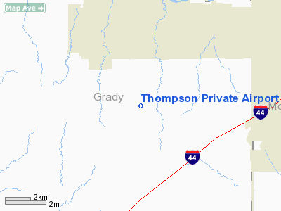
Location & QuickFacts
| FAA Information Effective: | 2008-09-25 |
| Airport Identifier: | 53OK |
| Airport Status: | Operational |
| Longitude/Latitude: | 097-46-01.1520W/35-15-00.2270N
-97.766987/35.250063 (Estimated) |
| Elevation: | 1280 ft / 390.14 m (Estimated) |
| Land: | 40 acres |
| From nearest city: | 3 nautical miles SE of Tuttle, OK |
| Location: | Grady County, OK |
| Magnetic Variation: | 08E (1980) |
Owner & Manager
| Ownership: | Privately owned |
| Address: |
|
| Manager: | Michael Thompson |
| Address: | Rt 1 Box 106b
Tuttle, OK 73089 |
| Phone number: | 405-381-3156 |
Airport Operations and Facilities
| Airport Use: | Private |
| Wind indicator: | Yes |
| Segmented Circle: | No |
| Control Tower: | No |
| Lighting Schedule: | PHONE REQ
FOR LIRL RY 17/35 CALL AMGR 405-381-3156. |
| Sectional chart: | Dallas-ft Worth |
| Region: | ASW - Southwest |
| Boundary ARTCC: | ZFW - Fort Worth |
| Tie-in FSS: | MLC - Mc Alester |
| FSS Toll Free: | 1-800-WX-BRIEF |
Runway Information
Runway 17/35
| Dimension: | 3000 x 100 ft / 914.4 x 30.5 m |
| Surface: | TURF, |
| Edge Lights: | Low
CENTER 2400' OF RY LGTD. |
| |
Runway 17 |
Runway 35 |
| Traffic Pattern: | Left | Left |
| Obstruction: | 30 ft pline, 400.0 ft from runway | 25 ft trees, 400.0 ft from runway |
|
Radio Navigation Aids
| ID |
Type |
Name |
Ch |
Freq |
Var |
Dist |
| FSI | FAN MARKER | Trail | | | 09E | 42.1 nm |
| OLR | NDB | Chickasha | | 290.00 | 07E | 13.3 nm |
| OUN | NDB | Norman | | 260.00 | 07E | 14.6 nm |
| OK | NDB | Tuloo | | 406.00 | 07E | 15.5 nm |
| RQO | NDB | El Reno | | 335.00 | 07E | 18.2 nm |
| LCY | NDB | Logan County | | 326.00 | 07E | 39.7 nm |
| PVJ | NDB | Pauls Valley | | 384.00 | 06E | 41.7 nm |
| OFZ | NDB | Trail | | 388.00 | 09E | 42.1 nm |
| OJA | NDB | Weatherford | | 272.00 | 07E | 47.4 nm |
| JWG | NDB | Watonga | | 359.00 | 07E | 48.9 nm |
| PFL | NDB | Post | | 308.00 | 08E | 49.7 nm |
| TIK | TACAN | Tinker | 105X | | 07E | 22.1 nm |
| PWA | VOR/DME | Wiley Post | 081X | 113.40 | 08E | 18.0 nm |
| IRW | VORTAC | Will Rogers | 088X | 114.10 | 07E | 10.1 nm |
| IFI | VORTAC | Kingfisher | 094X | 114.70 | 09E | 35.3 nm |
| OKC | VOT | Oklahoma Will Rgs W | | 108.80 | | 11.9 nm |
Images and information placed above are from
http://www.airport-data.com/airport/53OK/
We thank them for the data!
| General Info
|
| Country |
United States
|
| State |
OKLAHOMA
|
| FAA ID |
53OK
|
| Latitude |
35-15-00.227N
|
| Longitude |
097-46-01.152W
|
| Elevation |
1280 feet
|
| Near City |
TUTTLE
|
We don't guarantee the information is fresh and accurate. The data may
be wrong or outdated.
For more up-to-date information please refer to other sources.
|
|


