 |
|
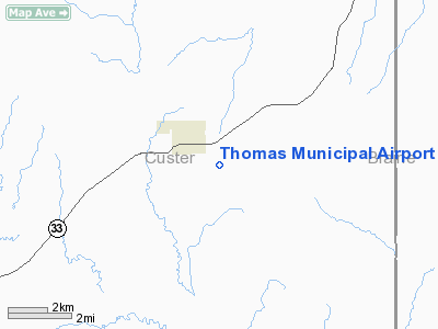
Location & QuickFacts
| FAA Information Effective: | 2008-09-25 |
| Airport Identifier: | 1O4 |
| Airport Status: | Operational |
| Longitude/Latitude: | 098-43-48.6000W/35-44-03.6900N
-98.730167/35.734358 (Estimated) |
| Elevation: | 1731 ft / 527.61 m (Estimated) |
| Land: | 80 acres |
| From nearest city: | 1 nautical miles SE of Thomas, OK |
| Location: | Custer County, OK |
| Magnetic Variation: | 08E (1985) |
Owner & Manager
| Ownership: | Publicly owned |
| Owner: | City Of Thomas |
| Address: | City Hall
Thomas, OK 73669 |
| Phone number: | 580-661-3687 |
| Manager: | Terry Thomson |
| Address: | 1 Airport Road
Thomas, OK 73669 |
| Phone number: | 580-661-2285 |
Airport Operations and Facilities
| Airport Use: | Open to public |
| Wind indicator: | Yes |
| Segmented Circle: | No |
| Control Tower: | No |
| Lighting Schedule: | DUSK-DAWN |
| Beacon Color: | Clear-Green (lighted land airport) |
| Landing fee charge: | No |
| Sectional chart: | Dallas-ft Worth |
| Region: | ASW - Southwest |
| Boundary ARTCC: | ZFW - Fort Worth |
| Tie-in FSS: | MLC - Mc Alester |
| FSS on Airport: | No |
| FSS Toll Free: | 1-800-WX-BRIEF |
| NOTAMs Facility: | MLC (NOTAM-d service avaliable) |
| Federal Agreements: | NY1 |
Airport Communications
Airport Services
| Bottled Oxygen: | NONE |
| Bulk Oxygen: | NONE |
Runway Information
Runway 17/35
| Dimension: | 3100 x 50 ft / 944.9 x 15.2 m |
| Surface: | ASPH, Good Condition |
| Weight Limit: | Single wheel: 4000 lbs. |
| Edge Lights: | Low
LIRL OTS INDEFLY. |
| |
Runway 17 |
Runway 35 |
| Longitude: | 098-43-48.9000W | 098-43-48.2963W |
| Latitude: | 35-44-19.0200N | 35-43-48.3661N |
| Elevation: | 1731.00 ft | 1731.00 ft |
| Alignment: | 127 | 127 |
| Traffic Pattern: | Left | Right |
| Markings: | Non-precision instrument, Good Condition | Non-precision instrument, Good Condition |
| Obstruction: | 15 ft road, 340.0 ft from runway, 9:1 slope to clear | , 50:1 slope to clear |
|
Radio Navigation Aids
| ID |
Type |
Name |
Ch |
Freq |
Var |
Dist |
| OJA | NDB | Weatherford | | 272.00 | 07E | 12.6 nm |
| CLK | NDB | Clinton | | 320.00 | 07E | 15.4 nm |
| JWG | NDB | Watonga | | 359.00 | 07E | 16.7 nm |
| BZ | NDB | Fossi | | 393.00 | 08E | 28.7 nm |
| FAU | NDB | Fairview | | 246.00 | 07E | 35.3 nm |
| EZY | NDB | Elk City | | 241.00 | 08E | 37.6 nm |
| RQO | NDB | El Reno | | 335.00 | 07E | 38.5 nm |
| IFI | VORTAC | Kingfisher | 094X | 114.70 | 09E | 35.7 nm |
| BFV | VORTAC | Burns Flat | 037X | 110.00 | 08E | 37.9 nm |
Images and information placed above are from
http://www.airport-data.com/airport/1O4/
We thank them for the data!
| General Info
|
| Country |
United States
|
| State |
OKLAHOMA
|
| FAA ID |
1O4
|
| Latitude |
35-44-00.176N
|
| Longitude |
098-43-50.298W
|
| Elevation |
1731 feet
|
| Near City |
THOMAS
|
We don't guarantee the information is fresh and accurate. The data may
be wrong or outdated.
For more up-to-date information please refer to other sources.
|
|


