 |
|
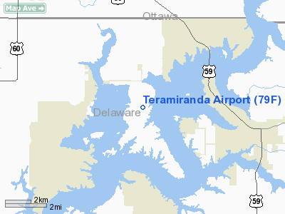
Location & QuickFacts
| FAA Information Effective: | 2008-09-25 |
| Airport Identifier: | 79F |
| Airport Status: | Operational |
| Longitude/Latitude: | 094-52-20.8430W/36-36-30.2760N
-94.872456/36.608410 (Estimated) |
| Elevation: | 793 ft / 241.71 m (Surveyed) |
| Land: | 40 acres |
| From nearest city: | 7 nautical miles SE of Afton, OK |
| Location: | Delaware County, OK |
| Magnetic Variation: | 05E (1985) |
Owner & Manager
| Ownership: | Privately owned |
| Owner: | Gene Gregg |
| Address: | 28251 S. 561 Road
Monkey Island, OK 74331 |
| Phone number: | 918-257-4274 |
| Manager: | Tom Berry |
| Address: | 28251 S. 561 Road
Monkey Island, OK 74331 |
| Phone number: | 918-257-4274 |
Airport Operations and Facilities
| Airport Use: | Open to public |
| Wind indicator: | Yes |
| Segmented Circle: | No |
| Control Tower: | No |
| Landing fee charge: | No |
| Sectional chart: | Kansas City |
| Region: | ASW - Southwest |
| Boundary ARTCC: | ZKC - Kansas City |
| Tie-in FSS: | MLC - Mc Alester |
| FSS on Airport: | No |
| FSS Toll Free: | 1-800-WX-BRIEF |
| NOTAMs Facility: | MLC (NOTAM-d service avaliable) |
Airport Communications
Airport Services
| Airframe Repair: | NONE |
| Power Plant Repair: | NONE |
Runway Information
Runway 18/36
| Dimension: | 2580 x 35 ft / 786.4 x 10.7 m |
| Surface: | TURF, Fair Condition |
| |
Runway 18 |
Runway 36 |
| Traffic Pattern: | Left | Left |
| Obstruction: | 15 ft road, 35.0 ft from runway, 2:1 slope to clear | 50 ft trees, 100.0 ft from runway, 70 ft right of centerline, 2:1 slope to clear |
|
Radio Navigation Aids
| ID |
Type |
Name |
Ch |
Freq |
Var |
Dist |
| SLG | NDB | Siloam Springs | | 284.00 | 04E | 31.3 nm |
| TQH | NDB | Tahlequah | | 215.00 | 05E | 41.5 nm |
| CFV | NDB | Coffeyville | | 212.00 | 05E | 44.5 nm |
| EOS | VOR/DME | Neosho | 120X | 117.30 | 07E | 25.3 nm |
| DAK | VOR/DME | Drake | 025X | 108.80 | 07E | 47.2 nm |
| OSW | VORTAC | Oswego | 123X | 117.60 | 08E | 36.6 nm |
| RZC | VORTAC | Razorback | 111X | 116.40 | 04E | 42.3 nm |
Images and information placed above are from
http://www.airport-data.com/airport/79F/
We thank them for the data!
| General Info
|
| Country |
United States
|
| State |
OKLAHOMA
|
| FAA ID |
79F
|
| Latitude |
36-36-30.276N
|
| Longitude |
094-52-20.843W
|
| Elevation |
793 feet
|
| Near City |
AFTON
|
We don't guarantee the information is fresh and accurate. The data may
be wrong or outdated.
For more up-to-date information please refer to other sources.
|
|


