 |
|
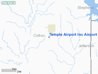
Temple Airport Inc Airport |
Location & QuickFacts
| FAA Information Effective: | 2008-09-25 |
| Airport Identifier: | OK79 |
| Airport Status: | Operational |
| Longitude/Latitude: | 098-14-28.1610W/34-15-24.3240N
-98.241156/34.256757 (Estimated) |
| Elevation: | 1005 ft / 306.32 m (Estimated) |
| Land: | 12 acres |
| From nearest city: | 1 nautical miles S of Temple, OK |
| Location: | Cotton County, OK |
| Magnetic Variation: | 07E (1985) |
Owner & Manager
| Ownership: | Privately owned |
| Owner: | Temple Airport Inc. |
| Address: | Box 493
Temple, OK 73568 |
| Manager: | N Uselton |
| Address: | Box 493
Temple, OK 73568 |
| Phone number: | 405-342-6969 |
Airport Operations and Facilities
| Airport Use: | Private |
| Wind indicator: | Yes |
| Segmented Circle: | No |
| Control Tower: | No |
| Landing fee charge: | No |
| Sectional chart: | Dallas-ft Worth |
| Region: | ASW - Southwest |
| Boundary ARTCC: | ZFW - Fort Worth |
| Tie-in FSS: | MLC - Mc Alester |
| FSS on Airport: | No |
| FSS Toll Free: | 1-800-WX-BRIEF |
Airport Services
| Airframe Repair: | NONE |
| Power Plant Repair: | NONE |
| Bottled Oxygen: | NONE |
| Bulk Oxygen: | NONE |
Runway Information
Runway 17/35
| Dimension: | 2600 x 30 ft / 792.5 x 9.1 m |
| Surface: | TRTD-DIRT, Fair Condition
NORTH 1200' TREATED. |
| |
Runway 17 |
Runway 35 |
| Traffic Pattern: | Left | Left |
| Obstruction: | | 4 ft fence, 0.0 ft from runway |
|
Radio Navigation Aids
| ID |
Type |
Name |
Ch |
Freq |
Var |
Dist |
| FSI | FAN MARKER | Trail | | | 09E | 32.5 nm |
| PFL | NDB | Post | | 308.00 | 08E | 22.6 nm |
| SKB | NDB | Scotland | | 344.00 | 08E | 30.6 nm |
| OFZ | NDB | Trail | | 388.00 | 09E | 32.5 nm |
| GMZ | NDB | Grindstone Mountain | | 356.00 | 07E | 45.6 nm |
| SHP | TACAN | Sheppard | 045X | | 10E | 20.5 nm |
| LAW | VOR/DME | Lawton | 031X | 109.40 | 09E | 16.7 nm |
| DUC | VOR/DME | Duncan | 047X | 111.00 | 09E | 17.8 nm |
| SPS | VORTAC | Wichita Falls | 074X | 112.70 | 10E | 23.9 nm |
| UKW | VORTAC | Bowie | 071X | 112.40 | 06E | 48.1 nm |
Images and information placed above are from
http://www.airport-data.com/airport/OK79/
We thank them for the data!
| General Info
|
| Country |
United States
|
| State |
OKLAHOMA
|
| FAA ID |
OK79
|
| Latitude |
34-15-24.324N
|
| Longitude |
098-14-28.161W
|
| Elevation |
1005 feet
|
| Near City |
TEMPLE
|
We don't guarantee the information is fresh and accurate. The data may
be wrong or outdated.
For more up-to-date information please refer to other sources.
|
|


