 |
|
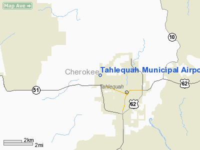
Location & QuickFacts
| FAA Information Effective: | 2008-09-25 |
| Airport Identifier: | TQH |
| Airport Status: | Operational |
| Longitude/Latitude: | 095-00-16.3000W/35-55-49.0000N
-95.004528/35.930278 (Estimated) |
| Elevation: | 874 ft / 266.40 m (Surveyed) |
| Land: | 125 acres |
| From nearest city: | 2 nautical miles NW of Tahlequah, OK |
| Location: | Cherokee County, OK |
| Magnetic Variation: | 05E (1995) |
Owner & Manager
| Ownership: | Publicly owned |
| Owner: | City Of Tahlequah |
| Address: | City Hall, 111 S. Cherokee
Tahlequah, OK 74464 |
| Phone number: | 918-456-0651 |
| Manager: | Greg Blish |
| Address: | City Hall, 111 S. Cherokee
Tahlequah, OK 74464 |
| Phone number: | 918-456-8731 |
Airport Operations and Facilities
| Airport Use: | Open to public |
| Wind indicator: | Yes |
| Segmented Circle: | No |
| Control Tower: | No |
| Lighting Schedule: | DUSK-DAWN
ACTVT MIRL RY 17/35; PAPI RYS 17 & 35 - CTAF. |
| Beacon Color: | Clear-Green (lighted land airport) |
| Landing fee charge: | No |
| Sectional chart: | Dallas-ft Worth |
| Region: | ASW - Southwest |
| Boundary ARTCC: | ZME - Memphis |
| Tie-in FSS: | MLC - Mc Alester |
| FSS on Airport: | No |
| FSS Toll Free: | 1-800-WX-BRIEF |
| NOTAMs Facility: | TQH (NOTAM-d service avaliable) |
| Federal Agreements: | NGY |
Airport Communications
| CTAF: | 122.800 |
| Unicom: | 122.800 |
Airport Services
| Fuel available: | 100LLA |
| Bottled Oxygen: | NONE |
| Bulk Oxygen: | NONE |
Runway Information
Runway 17/35
| Dimension: | 5001 x 75 ft / 1524.3 x 22.9 m |
| Surface: | ASPH, Good Condition |
| Weight Limit: | Single wheel: 26000 lbs. |
| Edge Lights: | Medium |
| |
Runway 17 |
Runway 35 |
| Longitude: | 095-00-15.0837W | 095-00-17.4535W |
| Latitude: | 35-56-13.7393N | 35-55-24.3268N |
| Elevation: | 869.00 ft | 851.00 ft |
| Alignment: | 127 | 2 |
| Traffic Pattern: | Left | Left |
| Markings: | Non-precision instrument, Good Condition | Non-precision instrument, Good Condition |
| Crossing Height: | 31.00 ft | 31.00 ft |
| VASI: | 4-light PAPI on left side | 4-light PAPI on left side |
| Visual Glide Angle: | 3.00° | 3.00° |
| Obstruction: | , 50:1 slope to clear | 20 ft trees, 360.0 ft from runway, 8:1 slope to clear |
|
Radio Navigation Aids
| ID |
Type |
Name |
Ch |
Freq |
Var |
Dist |
| TQH | NDB | Tahlequah | | 215.00 | 05E | 0.2 nm |
| MKO | NDB | Muskogee | | 306.00 | 06E | 24.4 nm |
| SLG | NDB | Siloam Springs | | 284.00 | 04E | 29.5 nm |
| IQS | NDB | Sallisaw | | 520.00 | 05E | 33.6 nm |
| DW | NDB | Owaso | | 375.00 | 06E | 48.0 nm |
| MEE | VOR | Davis | | 108.60 | 06E | 23.9 nm |
| DAK | VOR/DME | Drake | 025X | 108.80 | 07E | 39.8 nm |
| OKM | VOR/DME | Okmulgee | 096X | 114.90 | 08E | 44.3 nm |
| GNP | VOR/DME | Glenpool | 043X | 110.60 | 06E | 46.9 nm |
| TUL | VORTAC | Tulsa | 091X | 114.40 | 08E | 41.3 nm |
| RZC | VORTAC | Razorback | 111X | 116.40 | 04E | 46.9 nm |
| FSM | VORTAC | Fort Smith | 041X | 110.40 | 07E | 48.4 nm |
| TUL | VOT | Tulsa Intl | | 109.00 | | 41.3 nm |
Remarks
- PAEW ADJ ALL SURFACE AREAS.
- ULTRALIGHT ACTIVITY ON & INVOF ARPT.
- TWY EXITS A1, A2 & A4 CLSD INDEFLY.
Images and information placed above are from
http://www.airport-data.com/airport/TQH/
We thank them for the data!
| General Info
|
| Country |
United States
|
| State |
OKLAHOMA
|
| FAA ID |
TQH
|
| Latitude |
35-55-44.100N
|
| Longitude |
095-00-16.300W
|
| Elevation |
873 feet
|
| Near City |
TAHLEQUAH
|
We don't guarantee the information is fresh and accurate. The data may
be wrong or outdated.
For more up-to-date information please refer to other sources.
|
|


