 |
|
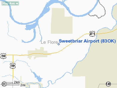
Location & QuickFacts
| FAA Information Effective: | 2008-09-25 |
| Airport Identifier: | 83OK |
| Airport Status: | Operational |
| Longitude/Latitude: | 094-34-40.7900W/35-15-24.3400N
-94.577997/35.256761 (Estimated) |
| Elevation: | 560 ft / 170.69 m (Estimated) |
| Land: | 0 acres |
| From nearest city: | 2 nautical miles E of Murry Spur, OK |
| Location: | Le Flore County, OK |
| Magnetic Variation: | 04E (1995) |
Owner & Manager
| Ownership: | Privately owned |
| Owner: | Lynne P Balzer |
| Address: | Route 4 Box 663
Spiro, OK 74959 |
| Phone number: | 918-962-5434 |
| Manager: | Lynne P Balzer |
| Address: | Route 4 Box 663
Spiro, OK 74959 |
| Phone number: | 918-962-5434 |
Airport Operations and Facilities
| Airport Use: | Private |
| Wind indicator: | Yes |
| Segmented Circle: | No |
| Control Tower: | No |
| Sectional chart: | Memphis |
| Region: | ASW - Southwest |
| Boundary ARTCC: | ZME - Memphis |
| Tie-in FSS: | MLC - Mc Alester |
| FSS on Airport: | No |
| FSS Toll Free: | 1-800-WX-BRIEF |
Runway Information
Runway 07/25
| Dimension: | 1747 x 28 ft / 532.5 x 8.5 m |
| Surface: | TURF, |
| |
Runway 07 |
Runway 25 |
| Traffic Pattern: | Left | Left |
| Displaced threshold: | 200.00 ft | 480.00 ft |
| Obstruction: | 12 ft trees, 35.0 ft from runway | 48 ft trees, 160.0 ft from runway |
|
Radio Navigation Aids
| ID |
Type |
Name |
Ch |
Freq |
Var |
Dist |
| IQS | NDB | Sallisaw | | 520.00 | 05E | 13.6 nm |
| MKO | NDB | Muskogee | | 306.00 | 06E | 40.2 nm |
| TQH | NDB | Tahlequah | | 215.00 | 05E | 45.4 nm |
| MEZ | NDB | Mena | | 242.00 | 04E | 46.3 nm |
| MEE | VOR | Davis | | 108.60 | 06E | 45.7 nm |
| FSM | VORTAC | Fort Smith | 041X | 110.40 | 07E | 17.0 nm |
| PGO | VORTAC | Rich Mountain | 082X | 113.50 | 04E | 34.7 nm |
Remarks
- OWNER DESIRES ARPT NOT BE CHARTED.
- RY TERRAIN SLIGHTLY ROLLING.
- PRVDD ARPT REMAINS VFR; OWNER & ALL USERS REMAIN IN COMPLIANCE WITH TITLE 14, CFR PART 91.127 & PART 91.130 AND PRIOR TO BEGINNING OPNS THE FT SMITH ATCT IS CONTACTED.
Images and information placed above are from
http://www.airport-data.com/airport/83OK/
We thank them for the data!
| General Info
|
| Country |
United States
|
| State |
OKLAHOMA
|
| FAA ID |
83OK
|
| Latitude |
35-15-24.340N
|
| Longitude |
094-34-40.790W
|
| Elevation |
560 feet
|
| Near City |
MURRY SPUR
|
We don't guarantee the information is fresh and accurate. The data may
be wrong or outdated.
For more up-to-date information please refer to other sources.
|
|


