 |
|
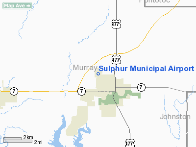
Location & QuickFacts
| FAA Information Effective: | 2008-09-25 |
| Airport Identifier: | F30 |
| Airport Status: | Operational |
| Longitude/Latitude: | 096-59-23.0620W/34-31-28.3180N
-96.989739/34.524533 (Estimated) |
| Elevation: | 1051 ft / 320.34 m (Estimated) |
| Land: | 115 acres |
| From nearest city: | 2 nautical miles NW of Sulphur, OK |
| Location: | Murray County, OK |
| Magnetic Variation: | 07E (1985) |
Owner & Manager
| Ownership: | Publicly owned |
| Owner: | City Of Sulphur |
| Address: | City Hall 600 W. Broadway
Sulphur, OK 73086 |
| Phone number: | 580-622-5096 |
| Manager: | Jack Beaty |
| Address: | City Hall 600 W. Broadway
Sulphur, OK 73086 |
| Phone number: | 580-622-5096 |
Airport Operations and Facilities
| Airport Use: | Open to public |
| Wind indicator: | Yes |
| Segmented Circle: | Yes |
| Control Tower: | No |
| Lighting Schedule: | DUSK-DAWN |
| Landing fee charge: | No |
| Sectional chart: | Dallas-ft Worth |
| Region: | ASW - Southwest |
| Boundary ARTCC: | ZFW - Fort Worth |
| Tie-in FSS: | MLC - Mc Alester |
| FSS on Airport: | No |
| FSS Toll Free: | 1-800-WX-BRIEF |
| NOTAMs Facility: | MLC (NOTAM-d service avaliable) |
| Federal Agreements: | NGY |
Airport Communications
Airport Services
| Fuel available: | 100LL
FUEL AVBL 24 HRS WITH CREDIT CARD. |
| Bottled Oxygen: | NONE |
| Bulk Oxygen: | NONE |
Runway Information
Runway 17/35
| Dimension: | 3500 x 60 ft / 1066.8 x 18.3 m |
| Surface: | ASPH, Good Condition |
| Weight Limit: | Single wheel: 12500 lbs. |
| Edge Lights: | Medium
MIRL OTS INDEFLY. |
| |
Runway 17 |
Runway 35 |
| Traffic Pattern: | Right | Left |
| Markings: | Basic, Fair Condition | Basic, Fair Condition |
| Obstruction: | 60 ft trees, 1300.0 ft from runway, 18:1 slope to clear
+10 FT ROAD 40 FT FM RY 17 THLD END. | 15 ft road, 500.0 ft from runway, 20:1 slope to clear |
|
Radio Navigation Aids
| ID |
Type |
Name |
Ch |
Freq |
Var |
Dist |
| PVJ | NDB | Pauls Valley | | 384.00 | 06E | 16.5 nm |
| AUV | NDB | Arbuckle | | 284.00 | 07E | 23.4 nm |
| HDL | NDB | Holdenville | | 411.00 | 06E | 44.1 nm |
| DNI | NDB | Denison | | 341.00 | 06E | 45.0 nm |
| DUA | NDB | Durant | | 359.00 | 05E | 45.6 nm |
| SRE | NDB | Seminole | | 278.00 | 06E | 47.5 nm |
| OUN | NDB | Norman | | 260.00 | 07E | 49.5 nm |
| GLE | NDB | Gainesville | | 330.00 | 06E | 49.5 nm |
| ADH | VOR/DME | Ada | 125X | 117.80 | 06E | 23.0 nm |
| URH | VOR/DME | Texoma | 090X | 114.30 | 05E | 45.8 nm |
| DUC | VOR/DME | Duncan | 047X | 111.00 | 09E | 46.7 nm |
| ADM | VORTAC | Ardmore | 114X | 116.70 | 06E | 20.8 nm |
Images and information placed above are from
http://www.airport-data.com/airport/F30/
We thank them for the data!
| General Info
|
| Country |
United States
|
| State |
OKLAHOMA
|
| FAA ID |
F30
|
| Latitude |
34-31-28.318N
|
| Longitude |
096-59-23.062W
|
| Elevation |
1051 feet
|
| Near City |
SULPHUR
|
We don't guarantee the information is fresh and accurate. The data may
be wrong or outdated.
For more up-to-date information please refer to other sources.
|
|


