 |
|
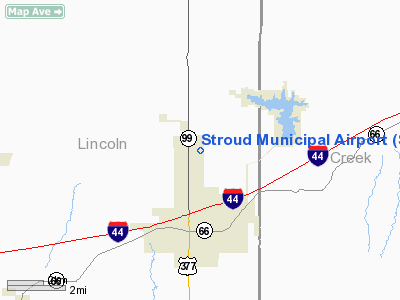
Location & QuickFacts
| FAA Information Effective: | 2008-09-25 |
| Airport Identifier: | SUD |
| Airport Status: | Operational |
| Longitude/Latitude: | 096-39-20.4000W/35-47-22.5000N
-96.655667/35.789583 (Estimated) |
| Elevation: | 900 ft / 274.32 m (Estimated) |
| Land: | 180 acres |
| From nearest city: | 3 nautical miles N of Stroud, OK |
| Location: | Lincoln County, OK |
| Magnetic Variation: | 06E (1985) |
Owner & Manager
| Ownership: | Publicly owned |
| Owner: | City Of Stroud |
| Address: | City Hall, Po Box 500
Stroud, OK 74079 |
| Phone number: | 918-968-2890 |
| Manager: | Howard Hadley |
| Address: | Po Box 460
Stroud, OK 74079 |
| Phone number: | 918-968-9561 |
Airport Operations and Facilities
| Airport Use: | Open to public |
| Wind indicator: | Yes |
| Segmented Circle: | No |
| Control Tower: | No |
| Lighting Schedule: | DUSK-DAWN |
| Landing fee charge: | No |
| Sectional chart: | Dallas-ft Worth |
| Region: | ASW - Southwest |
| Boundary ARTCC: | ZKC - Kansas City |
| Tie-in FSS: | MLC - Mc Alester |
| FSS on Airport: | No |
| FSS Toll Free: | 1-800-WX-BRIEF |
| NOTAMs Facility: | MLC (NOTAM-d service avaliable) |
| Federal Agreements: | NGY |
Airport Communications
Airport Services
| Bottled Oxygen: | NONE |
| Bulk Oxygen: | NONE |
Runway Information
Runway 18/36
| Dimension: | 3000 x 60 ft / 914.4 x 18.3 m |
| Surface: | ASPH, Good Condition |
| Weight Limit: | Single wheel: 12500 lbs. |
| Edge Lights: | Medium |
| |
Runway 18 |
Runway 36 |
| Longitude: | 096-39-22.4700W | 096-39-22.4600W |
| Latitude: | 35-47-39.1700N | 35-47-09.5000N |
| Elevation: | 901.00 ft | 892.00 ft |
| Alignment: | 127 | 127 |
| Traffic Pattern: | Left | Left |
| Markings: | Basic, Good Condition | Basic, Good Condition |
| VASI: | 2-light PAPI on left side | 2-light PAPI on left side |
| Obstruction: | 30 ft pline, 900.0 ft from runway, 23:1 slope to clear | , 50:1 slope to clear |
|
Radio Navigation Aids
| ID |
Type |
Name |
Ch |
Freq |
Var |
Dist |
| CUH | NDB | Cushing | | 242.00 | 05E | 8.4 nm |
| CQB | NDB | Tilghman | | 396.00 | 06E | 8.9 nm |
| TZO | NDB | Bristow | | 251.00 | 05E | 11.3 nm |
| GGU | NDB | Prague | | 314.00 | 06E | 16.7 nm |
| SRE | NDB | Seminole | | 278.00 | 06E | 31.1 nm |
| OWP | NDB | William Pogue | | 362.00 | 06E | 33.6 nm |
| LCY | NDB | Logan County | | 326.00 | 07E | 37.2 nm |
| HET | NDB | Henryetta | | 267.00 | 04E | 39.0 nm |
| HDL | NDB | Holdenville | | 411.00 | 06E | 44.0 nm |
| DW | NDB | Owaso | | 375.00 | 06E | 49.1 nm |
| TIK | TACAN | Tinker | 105X | | 07E | 41.3 nm |
| SWO | VOR/DME | Stillwater | 021X | 108.40 | 07E | 33.3 nm |
| GNP | VOR/DME | Glenpool | 043X | 110.60 | 06E | 34.4 nm |
| OKM | VOR/DME | Okmulgee | 096X | 114.90 | 08E | 39.0 nm |
| TUL | VORTAC | Tulsa | 091X | 114.40 | 08E | 48.8 nm |
| TUL | VOT | Tulsa Intl | | 109.00 | | 48.8 nm |
Remarks
- TWYS AND APRON CLSD INDEFLY.
- ESTAB PRIOR TO 1959.
Images and information placed above are from
http://www.airport-data.com/airport/SUD/
We thank them for the data!
| General Info
|
| Country |
United States
|
| State |
OKLAHOMA
|
| FAA ID |
SUD
|
| Latitude |
35-47-15.246N
|
| Longitude |
096-39-31.063W
|
| Elevation |
900 feet
|
| Near City |
STROUD
|
We don't guarantee the information is fresh and accurate. The data may
be wrong or outdated.
For more up-to-date information please refer to other sources.
|
|


