 |
|
Stillwater Regional Airport
Searcy Field |
| IATA: SWO – ICAO: KSWO – FAA LID: SWO |
| Summary |
| Airport type |
Public |
| Owner |
City of Stillwater |
| Serves |
Stillwater, Oklahoma |
| Elevation AMSL |
1,000 ft / 305 m |
| Coordinates |
36°09′40″N 097°05′08″W / 36.16111°N 97.08556°W / 36.16111; -97.08556 |
| Website |
stillwater.org/airport/ |
| Runways |
| Direction |
Length |
Surface |
| ft |
m |
| 17/35 |
7,401 |
2,256 |
Asphalt/Concrete |
| 4/22 |
5,002 |
1,525 |
Asphalt |
| Statistics (2009) |
| Aircraft operations |
71,707 |
| Based aircraft |
72 |
| Source: Federal Aviation Administration |
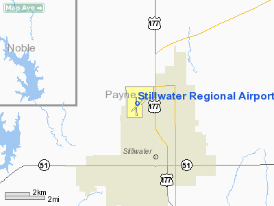
Stillwater Regional Airport (IATA: SWO, ICAO: KSWO, FAA LID: SWO) is a city-owned public-use airport located three nautical miles (6 km) northwest of the central business district of Stillwater, a city in Payne County, Oklahoma, United States. It is also known as Searcy Field. History
This airport was used for storage of several different types of bombers in the post WW-II era.
- Stillwater Regional Airport, was home to an Essential Air Service airline named Exec Express,Inc.. It operated Piper PA-31 Navajos.
- Ponca City News story about the storage of the airplanes at the airport and their sale to Paul Mantz: FAA Inspector Sees Stories in Old Planes
- Information from aerovintage.com about some planes being at the airport before being sold
Facilities and aircraft
Stillwater Regional Airport covers an area of 1,571 acres (636 ha) at an elevation of 1,000 feet (305 m) above mean sea level. It has two runways: 17/35 is 7,401 by 100 feet (2,256 x 30 m) with an asphalt and concrete surface; 4/22 is 5,002 by 75 feet (1,525 x 23 m) with an asphalt surface.
For the 12-month period ending May 31, 2009, the airport had 71,707 aircraft operations, an average of 196 per day: 95% general aviation, 3% military, 2% air taxi, and <1% scheduled commercial. At that time there were 72 aircraft based at this airport: 86% single-engine, 11% multi-engine, 1% helicopter and 1% ultralight.
The above content comes from Wikipedia and is published under free licenses – click here to read more.
Location & QuickFacts
| FAA Information Effective: | 2008-09-25 |
| Airport Identifier: | SWO |
| Airport Status: | Operational |
| Longitude/Latitude: | 097-05-08.5000W/36-09-40.4000N
-97.085694/36.161222 (Estimated) |
| Elevation: | 1000 ft / 304.80 m (Surveyed) |
| Land: | 1571 acres |
| From nearest city: | 3 nautical miles NW of Stillwater, OK |
| Location: | Payne County, OK |
| Magnetic Variation: | 05E (2005) |
Owner & Manager
| Ownership: | Publicly owned |
| Owner: | City Of Stillwater |
| Address: | 723 South Lewis
Stillwater, OK 74074 |
| Phone number: | 405-372-0025 |
| Manager: | Gary L. Johnson |
| Address: | 2020-1 West Apt Rd
Stillwater, OK 74075 |
| Phone number: | 405-372-7881 |
Airport Operations and Facilities
| Airport Use: | Open to public |
| Wind indicator: | Yes |
| Segmented Circle: | Yes |
| Control Tower: | Yes |
| Lighting Schedule: | DUSK-DAWN
MIRL RYS 04/22 & 17/35 PRESET LOW INTST; TO INCR INTST & ACTVT MALSR RY 17 & REIL RY 35 - CTAF. |
| Beacon Color: | Clear-Green (lighted land airport) |
| Landing fee charge: | No |
| Sectional chart: | Wichita |
| Region: | ASW - Southwest |
| Boundary ARTCC: | ZKC - Kansas City |
| Tie-in FSS: | MLC - Mc Alester |
| FSS on Airport: | No |
| FSS Toll Free: | 1-800-WX-BRIEF |
| NOTAMs Facility: | SWO (NOTAM-d service avaliable) |
| Certification type/date: | IV A U 05/197
24 HRS PPR FOR UNSKED ACR OPNS WITH MORE THAN 9 PSGR SEATS CALL AMGR 405-372-7881/6760. |
| Federal Agreements: | NGY3 |
Airport Communications
| CTAF: | 125.350 |
| Unicom: | 122.950 |
Airport Services
| Fuel available: | 100LLA |
| Airframe Repair: | MAJOR |
| Power Plant Repair: | MAJOR |
| Bottled Oxygen: | NONE |
Runway Information
Runway 04/22
| Dimension: | 5002 x 75 ft / 1524.6 x 22.9 m |
| Surface: | ASPH, Good Condition |
| Weight Limit: | Single wheel: 34000 lbs.
Dual wheel: 50000 lbs.
STRENGTHS BASED ON RESTRICTED OPNS. |
| Edge Lights: | Medium |
| |
Runway 04 |
Runway 22 |
| Longitude: | 097-05-26.0310W | 097-04-43.2750W |
| Latitude: | 36-09-19.3530N | 36-09-54.6270N |
| Elevation: | 960.00 ft | 984.00 ft |
| Alignment: | 45 | 127 |
| Traffic Pattern: | Left | Left |
| Markings: | Basic, Good Condition | Basic, Good Condition |
| Crossing Height: | 35.00 ft | 35.00 ft |
| VASI: | 4-light PAPI on left side | 4-box on left side |
| Visual Glide Angle: | 3.00° | 3.00° |
| Obstruction: | 3 ft gnd, 520.0 ft from runway, 45:1 slope to clear | , 50:1 slope to clear |
| Decleard distances: | Take off run available 5002.00 ft
Take off distance available 5002.00 ft
Actual stop distance available 5002.00 ft
Landing distance available 5002.00 ft
| Take off run available 5002.00 ft
Take off distance available 5002.00 ft
Actual stop distance available 5002.00 ft
Landing distance available 5002.00 ft
|
|
Runway 17/35
| Dimension: | 7401 x 100 ft / 2255.8 x 30.5 m |
| Surface: | ASPH-CONC, Good Condition |
| Surface Treatment: | Saw-cut or plastic Grooved |
| Weight Limit: | Single wheel: 100000 lbs.
Dual wheel: 157000 lbs.
Dual tandem wheel: 310000 lbs.
STRENGTHS BASED ON RESTRICTED OPNS. |
| Edge Lights: | Medium |
| |
Runway 17 |
Runway 35 |
| Longitude: | 097-05-12.6900W | 097-05-11.8940W |
| Latitude: | 36-10-20.3200N | 36-09-07.1620N |
| Elevation: | 1000.00 ft | 964.00 ft |
| Alignment: | 127 | 127 |
| ILS Type: | ILS/DME
| |
| Traffic Pattern: | Left | Left |
| Markings: | Precision instrument, Good Condition | Precision instrument, Good Condition |
| Crossing Height: | 48.00 ft | 26.00 ft |
| VASI: | 4-light PAPI on left side | 4-light PAPI on left side |
| Visual Glide Angle: | 3.00° | 3.00° |
| Approach lights: | MALSR | |
| Runway End Identifier: | | Yes |
| Decleard distances: | Take off run available 7401.00 ft
Take off distance available 7401.00 ft
Actual stop distance available 7401.00 ft
Landing distance available 7401.00 ft
| Take off run available 7401.00 ft
Take off distance available 7401.00 ft
Actual stop distance available 7401.00 ft
Landing distance available 7401.00 ft
|
|
Radio Navigation Aids
| ID |
Type |
Name |
Ch |
Freq |
Var |
Dist |
| CUH | NDB | Cushing | | 242.00 | 05E | 22.2 nm |
| LCY | NDB | Logan County | | 326.00 | 07E | 24.9 nm |
| CQB | NDB | Tilghman | | 396.00 | 06E | 29.4 nm |
| TZO | NDB | Bristow | | 251.00 | 05E | 39.8 nm |
| PN | NDB | Ponca | | 515.00 | 05E | 39.9 nm |
| GGU | NDB | Prague | | 314.00 | 06E | 42.7 nm |
| OWP | NDB | William Pogue | | 362.00 | 06E | 45.2 nm |
| OK | NDB | Tuloo | | 406.00 | 07E | 48.6 nm |
| TIK | TACAN | Tinker | 105X | | 07E | 45.9 nm |
| SWO | VOR/DME | Stillwater | 021X | 108.40 | 07E | 3.8 nm |
| ODG | VOR/DME | Woodring | 027X | 109.00 | 08E | 36.4 nm |
| PWA | VOR/DME | Wiley Post | 081X | 113.40 | 08E | 46.6 nm |
| PER | VORTAC | Pioneer | 079X | 113.20 | 06E | 35.4 nm |
| END | VORTAC | Vance | 101X | 115.40 | 09E | 41.9 nm |
| IFI | VORTAC | Kingfisher | 094X | 114.70 | 09E | 49.5 nm |
Remarks
- TPA FOR LIGHT ACFT 815 FT AGL; TPA FOR TURBO PROP & JETS 1515 FT AGL.
- ARFF INDEX C AVBL BY PRIOR ARRANGEMENT.
- ARFF INDEX B MAINTAINED.
- PRE DATES THE ACT.
Images and information placed above are from
http://www.airport-data.com/airport/SWO/
We thank them for the data!
| General Info
|
| Country |
United States
|
| State |
OKLAHOMA
|
| FAA ID |
SWO
|
| Latitude |
36-09-36.907N
|
| Longitude |
097-05-08.773W
|
| Elevation |
986 feet
|
| Near City |
STILLWATER
|
We don't guarantee the information is fresh and accurate. The data may
be wrong or outdated.
For more up-to-date information please refer to other sources.
|
|


