 |
|
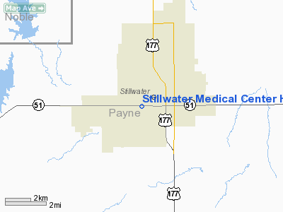
Stillwater Medical Center Heliport |
Location & QuickFacts
| FAA Information Effective: | 2008-09-25 |
| Airport Identifier: | 04OK |
| Airport Status: | Operational |
| Longitude/Latitude: | 097-04-46.1260W/36-06-55.1830N
-97.079479/36.115329 (Estimated) |
| Elevation: | 984 ft / 299.92 m (Estimated) |
| Land: | 0 acres |
| From nearest city: | 0 nautical miles N of Stillwater, OK |
| Location: | Payne County, OK |
| Magnetic Variation: | 06E (2000) |
Owner & Manager
| Ownership: | Privately owned |
| Owner: | Stillwater Medical Center |
| Address: | Po Box 2408
Stillwater, OK 74076 |
| Phone number: | 405-372-1480 |
| Manager: | Jerry Moeller |
| Address: | Po Box 2408
Stillwater, OK 74074 |
| Phone number: | 405-372-1480 |
Airport Operations and Facilities
| Airport Use: | Private
MEDICAL. |
| Wind indicator: | Yes |
| Segmented Circle: | No |
| Control Tower: | No |
| Landing fee charge: | No |
| Sectional chart: | Wichita |
| Region: | ASW - Southwest |
| Boundary ARTCC: | ZKC - Kansas City |
| Tie-in FSS: | MLC - Mc Alester |
| FSS on Airport: | No |
| FSS Toll Free: | 1-800-WX-BRIEF |
Runway Information
Helipad H1
| Dimension: | 45 x 45 ft / 13.7 x 13.7 m |
| Surface: | CONC, |
| |
Runway H1 |
Runway |
| Traffic Pattern: | Left | Left |
|
Radio Navigation Aids
| ID |
Type |
Name |
Ch |
Freq |
Var |
Dist |
| CUH | NDB | Cushing | | 242.00 | 05E | 20.1 nm |
| LCY | NDB | Logan County | | 326.00 | 07E | 23.0 nm |
| CQB | NDB | Tilghman | | 396.00 | 06E | 26.8 nm |
| TZO | NDB | Bristow | | 251.00 | 05E | 38.0 nm |
| GGU | NDB | Prague | | 314.00 | 06E | 40.0 nm |
| PN | NDB | Ponca | | 515.00 | 05E | 42.7 nm |
| OWP | NDB | William Pogue | | 362.00 | 06E | 45.0 nm |
| OK | NDB | Tuloo | | 406.00 | 07E | 46.4 nm |
| TIK | TACAN | Tinker | 105X | | 07E | 43.3 nm |
| SWO | VOR/DME | Stillwater | 021X | 108.40 | 07E | 6.5 nm |
| ODG | VOR/DME | Woodring | 027X | 109.00 | 08E | 37.7 nm |
| PWA | VOR/DME | Wiley Post | 081X | 113.40 | 08E | 44.6 nm |
| PER | VORTAC | Pioneer | 079X | 113.20 | 06E | 38.1 nm |
| END | VORTAC | Vance | 101X | 115.40 | 09E | 43.0 nm |
| IFI | VORTAC | Kingfisher | 094X | 114.70 | 09E | 48.7 nm |
Images and information placed above are from
http://www.airport-data.com/airport/04OK/
We thank them for the data!
| General Info
|
| Country |
United States
|
| State |
OKLAHOMA
|
| FAA ID |
04OK
|
| Latitude |
36-06-55.183N
|
| Longitude |
097-04-46.126W
|
| Elevation |
984 feet
|
| Near City |
STILLWATER
|
We don't guarantee the information is fresh and accurate. The data may
be wrong or outdated.
For more up-to-date information please refer to other sources.
|
|


