 |
|
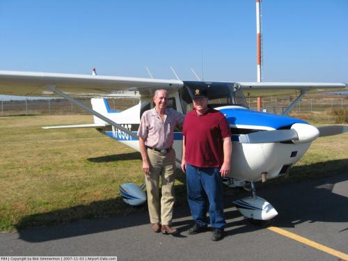 |
(Click on the photo to enlarge) |
Location & QuickFacts
| FAA Information Effective: | 2008-09-25 |
| Airport Identifier: | F84 |
| Airport Status: | Operational |
| Longitude/Latitude: | 095-05-38.0000W/35-17-20.8000N
-95.093889/35.289111 (Estimated) |
| Elevation: | 599 ft / 182.58 m (Surveyed) |
| Land: | 166 acres |
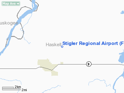
| From nearest city: | 3 nautical miles NE of Stigler, OK |
| Location: | Haskell County, OK |
| Magnetic Variation: | 05E (1985) |
Owner & Manager
| Ownership: | Publicly owned |
| Owner: | City Of Stigler |
| Address: | City Hall
Stigler, OK 74462 |
| Phone number: | 918-967-2164 |
| Manager: | Pete Bass, City Mgr |
| Address: | 115 S Bdwy
Stigler, OK 74462 |
| Phone number: | 918-448-0150 |
Airport Operations and Facilities
| Airport Use: | Open to public |
| Wind indicator: | Yes |
| Segmented Circle: | Yes |
| Control Tower: | No |
| Lighting Schedule: | DUSK-DAWN
ACTVT LIRL RY 17/35; VASI RYS 17 & 35 - CTAF. |
| Beacon Color: | Clear-Green (lighted land airport) |
| Landing fee charge: | No |
| Sectional chart: | Dallas-ft Worth |
| Region: | ASW - Southwest |
| Boundary ARTCC: | ZFW - Fort Worth |
| Tie-in FSS: | MLC - Mc Alester |
| FSS on Airport: | No |
| FSS Toll Free: | 1-800-WX-BRIEF |
| NOTAMs Facility: | MLC (NOTAM-d service avaliable) |
| Federal Agreements: | NGY |
Airport Communications
Airport Services
| Fuel available: | 100LL
FOR FUEL CTC POLICE 918-967-3377. |
Runway Information
Runway 17/35
| Dimension: | 3606 x 60 ft / 1099.1 x 18.3 m |
| Surface: | ASPH, Good Condition |
| Weight Limit: | Single wheel: 12500 lbs. |
| Edge Lights: | Low |
| |
Runway 17 |
Runway 35 |
| Longitude: | 095-05-37.8458W | 095-05-38.0700W |
| Latitude: | 35-17-38.6373N | 35-17-02.9700N |
| Elevation: | 599.00 ft | 598.00 ft |
| Alignment: | 127 | 0 |
| Traffic Pattern: | Left | Left |
| Markings: | Non-precision instrument, Good Condition | Non-precision instrument, Good Condition |
| Displaced threshold: | 95.00 ft | 0.00 ft |
| VASI: | 2-box on left side | 2-box on left side |
| Obstruction: | 57 ft pline, 966.0 ft from runway, 13:1 slope to clear
APCH SLOPE 18:1 FM DSPLCD THLD. | 60 ft trees, 918.0 ft from runway, 250 ft left of centerline, 11:1 slope to clear |
|
Radio Navigation Aids
| ID |
Type |
Name |
Ch |
Freq |
Var |
Dist |
| IQS | NDB | Sallisaw | | 520.00 | 05E | 16.1 nm |
| MKO | NDB | Muskogee | | 306.00 | 06E | 20.7 nm |
| TQH | NDB | Tahlequah | | 215.00 | 05E | 38.6 nm |
| HET | NDB | Henryetta | | 267.00 | 04E | 45.6 nm |
| MEE | VOR | Davis | | 108.60 | 06E | 26.2 nm |
| OKM | VOR/DME | Okmulgee | 096X | 114.90 | 08E | 44.9 nm |
| FSM | VORTAC | Fort Smith | 041X | 110.40 | 07E | 40.8 nm |
| MLC | VORTAC | Mc Alester | 057X | 112.00 | 08E | 43.0 nm |
| PGO | VORTAC | Rich Mountain | 082X | 113.50 | 04E | 43.7 nm |
Images and information placed above are from
http://www.airport-data.com/airport/F84/
We thank them for the data!
| General Info
|
| Country |
United States
|
| State |
OKLAHOMA
|
| FAA ID |
F84
|
| Latitude |
35-17-20.780N
|
| Longitude |
095-05-38.030W
|
| Elevation |
600 feet
|
| Near City |
STIGLER
|
We don't guarantee the information is fresh and accurate. The data may
be wrong or outdated.
For more up-to-date information please refer to other sources.
|
|


