 |
|
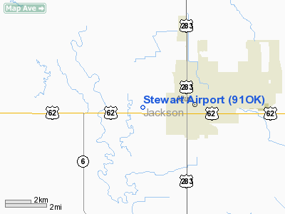
Location & QuickFacts
| FAA Information Effective: | 2008-09-25 |
| Airport Identifier: | 91OK |
| Airport Status: | Operational |
| Longitude/Latitude: | 099-22-16.3140W/34-38-31.2490N
-99.371198/34.642014 (Estimated) |
| Elevation: | 1365 ft / 416.05 m (Estimated) |
| Land: | 0 acres |
| From nearest city: | 2 nautical miles W of Altus, OK |
| Location: | Jackson County, OK |
| Magnetic Variation: | 08E (1985) |
Owner & Manager
| Ownership: | Privately owned |
| Owner: | Scotty's Llc |
| Address: | 20191 #2 Us Hwy 62
Altus, OK 73521 |
| Phone number: | 405-482-1011 |
| Manager: | Roy Lee Scott |
| Address: | 20191 #2 Us Hwy 62
Altus, OK 73522 |
| Phone number: | 580-481-8858 |
Airport Operations and Facilities
| Airport Use: | Private |
| Segmented Circle: | No |
| Control Tower: | No |
| Sectional chart: | Dallas-ft Worth |
| Region: | ASW - Southwest |
| Boundary ARTCC: | ZFW - Fort Worth |
| Tie-in FSS: | MLC - Mc Alester |
| FSS Toll Free: | 1-800-WX-BRIEF |
Runway Information
Runway 17/35
| Dimension: | 2300 x 100 ft / 701.0 x 30.5 m |
| Surface: | TURF, |
| |
Runway 17 |
Runway 35 |
| Traffic Pattern: | Left | Left |
| Obstruction: | 24 ft plines, 554.0 ft from runway | |
|
Radio Navigation Aids
| ID |
Type |
Name |
Ch |
Freq |
Var |
Dist |
| FSI | FAN MARKER | Trail | | | 09E | 48.6 nm |
| VRT | NDB | Wilbarger | | 230.00 | 08E | 25.4 nm |
| EZY | NDB | Elk City | | 241.00 | 08E | 47.1 nm |
| PFL | NDB | Post | | 308.00 | 08E | 47.9 nm |
| OFZ | NDB | Trail | | 388.00 | 09E | 48.6 nm |
| BZ | NDB | Fossi | | 393.00 | 08E | 49.3 nm |
| LAW | VOR/DME | Lawton | 031X | 109.40 | 09E | 48.2 nm |
| LTS | VORTAC | Altus | 035X | 109.80 | 08E | 5.1 nm |
| HBR | VORTAC | Hobart | 055X | 111.80 | 10E | 20.3 nm |
| BFV | VORTAC | Burns Flat | 037X | 110.00 | 08E | 36.7 nm |
| SYO | VORTAC | Sayre | 099X | 115.20 | 10E | 44.2 nm |
| CDS | VORTAC | Childress | 123X | 117.60 | 10E | 48.3 nm |
Remarks
- PRVDD RY THRS BE LOCATED AND MKD TO PROVIDE A 20:1 APCH SURFACE SLOPE OVER ALL OBSTACLES; AND REFERENCE BE MADE TO AC 150/5300-4B.
Images and information placed above are from
http://www.airport-data.com/airport/91OK/
We thank them for the data!
| General Info
|
| Country |
United States
|
| State |
OKLAHOMA
|
| FAA ID |
91OK
|
| Latitude |
34-38-31.249N
|
| Longitude |
099-22-16.314W
|
| Elevation |
1365 feet
|
| Near City |
ALTUS
|
We don't guarantee the information is fresh and accurate. The data may
be wrong or outdated.
For more up-to-date information please refer to other sources.
|
|


