 |
|
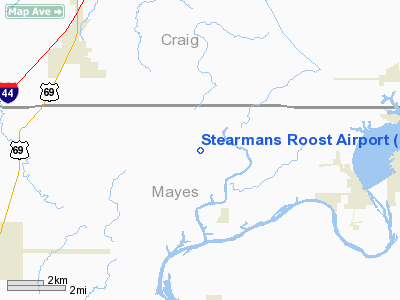
Location & QuickFacts
| FAA Information Effective: | 2008-09-25 |
| Airport Identifier: | 5OK3 |
| Airport Status: | Operational |
| Longitude/Latitude: | 095-08-37.8780W/36-29-18.3110N
-95.143855/36.488420 (Estimated) |
| Elevation: | 702 ft / 213.97 m (Estimated) |
| Land: | 0 acres |
| From nearest city: | 10 nautical miles S of Vinita, OK |
| Location: | Mayes County, OK |
| Magnetic Variation: | 05E (1985) |
Owner & Manager
| Ownership: | Privately owned |
| Owner: | George O Colvin |
| Address: | Rt 1, Box 257
Big Cabin, OK 74332 |
| Phone number: | 918-557-1999 |
| Manager: | George O Colvin |
| Address: | Rt 1, Box 257
Big Cabin, OK 74332 |
| Phone number: | 918-557-1999 |
Airport Operations and Facilities
| Airport Use: | Private |
| Wind indicator: | Yes |
| Segmented Circle: | No |
| Control Tower: | No |
| Landing fee charge: | No |
| Sectional chart: | Kansas City |
| Region: | ASW - Southwest |
| Boundary ARTCC: | ZKC - Kansas City |
| Tie-in FSS: | MLC - Mc Alester |
| FSS on Airport: | No |
| FSS Toll Free: | 1-800-WX-BRIEF |
Airport Services
| Airframe Repair: | MAJOR |
| Power Plant Repair: | MAJOR |
Runway Information
Runway 09/27
| Dimension: | 4000 x 100 ft / 1219.2 x 30.5 m |
| Surface: | TURF, |
| |
Runway 09 |
Runway 27 |
| Traffic Pattern: | Left | Left |
|
Radio Navigation Aids
| ID |
Type |
Name |
Ch |
Freq |
Var |
Dist |
| TQH | NDB | Tahlequah | | 215.00 | 05E | 34.4 nm |
| SLG | NDB | Siloam Springs | | 284.00 | 04E | 36.5 nm |
| DW | NDB | Owaso | | 375.00 | 06E | 37.0 nm |
| CFV | NDB | Coffeyville | | 212.00 | 05E | 41.8 nm |
| EOS | VOR/DME | Neosho | 120X | 117.30 | 07E | 40.2 nm |
| BVO | VOR/DME | Bartlesville | 126X | 117.90 | 08E | 47.0 nm |
| TUL | VORTAC | Tulsa | 091X | 114.40 | 08E | 35.8 nm |
| OSW | VORTAC | Oswego | 123X | 117.60 | 08E | 40.3 nm |
| TUL | VOT | Tulsa Intl | | 109.00 | | 35.8 nm |
Remarks
- PRVDD RWY THRS ARE DSPLCD A SUFFICIENT DIST TO PRVD A MIN 20:1 CLEARENCE OVER ANY & ALL OBSTRUCTIONS IN THE APCH.
Images and information placed above are from
http://www.airport-data.com/airport/5OK3/
We thank them for the data!
| General Info
|
| Country |
United States
|
| State |
OKLAHOMA
|
| FAA ID |
5OK3
|
| Latitude |
36-29-18.311N
|
| Longitude |
095-08-37.878W
|
| Elevation |
702 feet
|
| Near City |
VINITA
|
We don't guarantee the information is fresh and accurate. The data may
be wrong or outdated.
For more up-to-date information please refer to other sources.
|
|


