 |
|
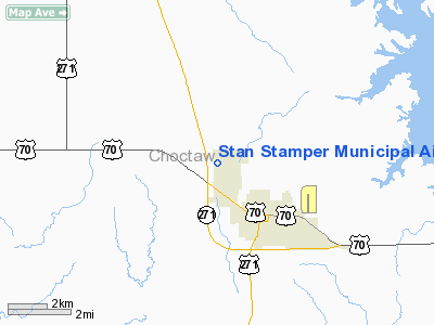
Stan Stamper Muni Airport |
Location & QuickFacts
| FAA Information Effective: | 2008-09-25 |
| Airport Identifier: | HHW |
| Airport Status: | Operational |
| Longitude/Latitude: | 095-32-30.8620W/34-02-05.3720N
-95.541906/34.034826 (Estimated) |
| Elevation: | 572 ft / 174.35 m (Estimated) |
| Land: | 167 acres |
| From nearest city: | 2 nautical miles NW of Hugo, OK |
| Location: | Choctaw County, OK |
| Magnetic Variation: | 05E (1990) |
Owner & Manager
| Ownership: | Publicly owned |
| Owner: | City Of Hugo |
| Address: | 201 S Second St
Hugo, OK 74743 |
| Phone number: | 580-326-2344 |
| Manager: | Dorsey Myers |
| Address: | Rt 1 Box 139
Hugo, OK 74743 |
| Phone number: | 580-326-2335 |
Airport Operations and Facilities
| Airport Use: | Open to public |
| Wind indicator: | Yes |
| Segmented Circle: | Yes |
| Control Tower: | No |
| Lighting Schedule: | DUSK-DAWN
MIRL RY 17/35 PRESET LOW INTST; TO INCR INTST ACTVT - CTAF. |
| Beacon Color: | Clear-Green (lighted land airport) |
| Sectional chart: | Dallas-ft Worth |
| Region: | ASW - Southwest |
| Boundary ARTCC: | ZFW - Fort Worth |
| Tie-in FSS: | MLC - Mc Alester |
| FSS Toll Free: | 1-800-WX-BRIEF |
| NOTAMs Facility: | MLC (NOTAM-d service avaliable) |
| Federal Agreements: | NGY |
Airport Communications
| CTAF: | 122.800 |
| Unicom: | 122.800 |
Airport Services
Runway Information
Runway 17/35
| Dimension: | 4007 x 75 ft / 1221.3 x 22.9 m |
| Surface: | ASPH, Good Condition |
| Pavement Class: | 4 /F/C/Y/U |
| Weight Limit: | Single wheel: 12500 lbs. |
| Edge Lights: | Medium |
| |
Runway 17 |
Runway 35 |
| Longitude: | 095-32-31.4750W | 095-32-31.3660W |
| Latitude: | 34-02-20.9330N | 34-01-41.2900N |
| Elevation: | 567.00 ft | 572.00 ft |
| Alignment: | 127 | 0 |
| Traffic Pattern: | Left | Left |
| Markings: | Non-precision instrument, Good Condition | Non-precision instrument, Good Condition |
| Obstruction: | 40 ft trees, 1200.0 ft from runway, 25:1 slope to clear | 25 ft trees, 600.0 ft from runway, 16:1 slope to clear |
|
Radio Navigation Aids
| ID |
Type |
Name |
Ch |
Freq |
Var |
Dist |
| HHW | NDB | Hugo | | 323.00 | 05E | 0.3 nm |
| AEE | NDB | Antlers | | 391.00 | 05E | 10.9 nm |
| IBO | NDB | Idabel | | 271.00 | 03E | 35.7 nm |
| HJM | NDB | Rayburn | | 415.00 | 06E | 40.5 nm |
| DUA | NDB | Durant | | 359.00 | 05E | 43.1 nm |
| PRX | VOR/DME | Paris | 083X | 113.60 | 07E | 30.0 nm |
| URH | VOR/DME | Texoma | 090X | 114.30 | 05E | 42.7 nm |
| BYP | VORTAC | Bonham | 093X | 114.60 | 06E | 45.7 nm |
Remarks
- PRVDD ANTENNA 9000 FT SE OF ARPT REMOVED.
Images and information placed above are from
http://www.airport-data.com/airport/HHW/
We thank them for the data!
| General Info
|
| Country |
United States
|
| State |
OKLAHOMA
|
| FAA ID |
HHW
|
| Latitude |
34-02-05.372N
|
| Longitude |
095-32-30.862W
|
| Elevation |
571 feet
|
| Near City |
HUGO
|
We don't guarantee the information is fresh and accurate. The data may
be wrong or outdated.
For more up-to-date information please refer to other sources.
|
|


