 |
|
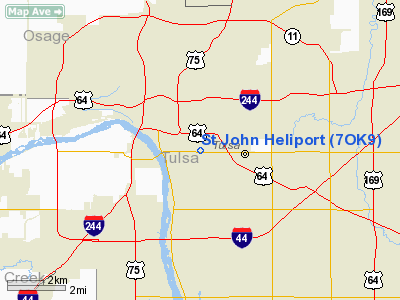
Location & QuickFacts
| FAA Information Effective: | 2008-09-25 |
| Airport Identifier: | 7OK9 |
| Airport Status: | Operational |
| Longitude/Latitude: | 095-57-58.9830W/36-08-03.3370N
-95.966384/36.134260 (Estimated) |
| Elevation: | 740 ft / 225.55 m (Estimated) |
| Land: | 0 acres |
| From nearest city: | 2 nautical miles SE of Tulsa, OK |
| Location: | Tulsa County, OK |
| Magnetic Variation: | 06E (1985) |
Owner & Manager
| Ownership: | Privately owned |
| Owner: | St John Medical Center |
| Address: | 1923 S. Utica Ave.
Tulsa, OK 74104 |
| Phone number: | 918-744-2180 |
| Manager: | Dewey W. Davis |
| Address: | 1923 S. Utica Ave
Tulsa, OK 74104
C/O ST JOHN MEDICAL CENTER |
| Phone number: | 918-744-2780 |
Airport Operations and Facilities
| Airport Use: | Private
MEDICAL. |
| Wind indicator: | Yes |
| Segmented Circle: | No |
| Control Tower: | No |
| Landing fee charge: | No |
| Sectional chart: | Kansas City |
| Region: | ASW - Southwest |
| Boundary ARTCC: | ZKC - Kansas City |
| Tie-in FSS: | MLC - Mc Alester |
| FSS on Airport: | No |
| FSS Toll Free: | 1-800-WX-BRIEF |
Runway Information
Helipad H1
| Dimension: | 100 x 100 ft / 30.5 x 30.5 m |
| Surface: | CONC, |
| |
Runway H1 |
Runway |
| Traffic Pattern: | Left | Left |
|
Radio Navigation Aids
| ID |
Type |
Name |
Ch |
Freq |
Var |
Dist |
| OWP | NDB | William Pogue | | 362.00 | 06E | 9.4 nm |
| DW | NDB | Owaso | | 375.00 | 06E | 11.3 nm |
| TZO | NDB | Bristow | | 251.00 | 05E | 31.3 nm |
| CUH | NDB | Cushing | | 242.00 | 05E | 42.0 nm |
| HET | NDB | Henryetta | | 267.00 | 04E | 43.9 nm |
| MKO | NDB | Muskogee | | 306.00 | 06E | 46.3 nm |
| CQB | NDB | Tilghman | | 396.00 | 06E | 48.3 nm |
| TQH | NDB | Tahlequah | | 215.00 | 05E | 48.3 nm |
| MEE | VOR | Davis | | 108.60 | 06E | 40.6 nm |
| GNP | VOR/DME | Glenpool | 043X | 110.60 | 06E | 12.8 nm |
| OKM | VOR/DME | Okmulgee | 096X | 114.90 | 08E | 27.0 nm |
| BVO | VOR/DME | Bartlesville | 126X | 117.90 | 08E | 42.1 nm |
| TUL | VORTAC | Tulsa | 091X | 114.40 | 08E | 9.4 nm |
| TUL | VOT | Tulsa Intl | | 109.00 | | 9.4 nm |
Remarks
- PRVDD HELI NOT USED IF TLWD EXCEEDS 8 KNOTS; LNDG AREA MUST BE CLEAR OF ALL TFC DURG OPNS & MUST BE VFR; NGT OPNS PROHIBITED TIL APROP LGTS INSTALLED; ALL OPNS TO BE IAW FARS/AIR TAXI CERT HOLDERS MANUAL.
Images and information placed above are from
http://www.airport-data.com/airport/7OK9/
We thank them for the data!
| General Info
|
| Country |
United States
|
| State |
OKLAHOMA
|
| FAA ID |
7OK9
|
| Latitude |
36-08-03.337N
|
| Longitude |
095-57-58.983W
|
| Elevation |
740 feet
|
| Near City |
TULSA
|
We don't guarantee the information is fresh and accurate. The data may
be wrong or outdated.
For more up-to-date information please refer to other sources.
|
|


