 |
|
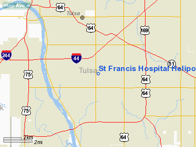
St Francis Hospital Heliport |
Location & QuickFacts
| FAA Information Effective: | 2008-09-25 |
| Airport Identifier: | 4OK3 |
| Airport Status: | Operational |
| Longitude/Latitude: | 095-55-07.9720W/36-04-30.3450N
-95.918881/36.075096 (Estimated) |
| Elevation: | 752 ft / 229.21 m (Surveyed) |
| Land: | 0 acres |
| From nearest city: | 4 nautical miles SE of Tulsa, OK |
| Location: | Tulsa County, OK |
| Magnetic Variation: | 06E (1985) |
Owner & Manager
| Ownership: | Privately owned |
| Owner: | Susan Cook |
| Address: | 6161 S. Yale
Tulsa, OK 74136 |
| Phone number: | 918-494-6542 |
| Manager: | Charlotte Ankershell
OTHER CONTACT: RANDY WARREN 918-494-6526 |
| Address: | St Francis Hosp 6161 S Yale
Tulsa, OK 74136 |
| Phone number: | 918-494-6977 |
Airport Operations and Facilities
| Airport Use: | Private
MEDICAL. |
| Wind indicator: | Yes |
| Segmented Circle: | Yes |
| Control Tower: | No |
| Lighting Schedule: | PHONE REQ
FOR PERIMETER LGTS CALL 918-494-2200. |
| Landing fee charge: | No |
| Sectional chart: | Kansas City |
| Region: | ASW - Southwest |
| Boundary ARTCC: | ZKC - Kansas City |
| Tie-in FSS: | MLC - Mc Alester |
| FSS on Airport: | No |
| FSS Toll Free: | 1-800-WX-BRIEF |
Airport Communications
Airport Services
| Fuel available: | A |
| Airframe Repair: | NONE |
| Power Plant Repair: | NONE |
Runway Information
Helipad H1
| Dimension: | 40 x 40 ft / 12.2 x 12.2 m |
| Surface: | CONC, |
| |
Runway H1 |
Runway |
| Traffic Pattern: | Left | Left |
|
Radio Navigation Aids
| ID |
Type |
Name |
Ch |
Freq |
Var |
Dist |
| OWP | NDB | William Pogue | | 362.00 | 06E | 12.8 nm |
| DW | NDB | Owaso | | 375.00 | 06E | 14.1 nm |
| TZO | NDB | Bristow | | 251.00 | 05E | 30.7 nm |
| HET | NDB | Henryetta | | 267.00 | 04E | 40.6 nm |
| MKO | NDB | Muskogee | | 306.00 | 06E | 42.2 nm |
| CUH | NDB | Cushing | | 242.00 | 05E | 43.1 nm |
| TQH | NDB | Tahlequah | | 215.00 | 05E | 45.3 nm |
| CQB | NDB | Tilghman | | 396.00 | 06E | 48.7 nm |
| MEE | VOR | Davis | | 108.60 | 06E | 36.5 nm |
| GNP | VOR/DME | Glenpool | 043X | 110.60 | 06E | 9.6 nm |
| OKM | VOR/DME | Okmulgee | 096X | 114.90 | 08E | 23.1 nm |
| BVO | VOR/DME | Bartlesville | 126X | 117.90 | 08E | 45.9 nm |
| TUL | VORTAC | Tulsa | 091X | 114.40 | 08E | 9.7 nm |
| TUL | VOT | Tulsa Intl | | 109.00 | | 9.7 nm |
Remarks
Images and information placed above are from
http://www.airport-data.com/airport/4OK3/
We thank them for the data!
| General Info
|
| Country |
United States
|
| State |
OKLAHOMA
|
| FAA ID |
4OK3
|
| Latitude |
36-04-30.345N
|
| Longitude |
095-55-07.972W
|
| Elevation |
752 feet
|
| Near City |
TULSA
|
We don't guarantee the information is fresh and accurate. The data may
be wrong or outdated.
For more up-to-date information please refer to other sources.
|
|


