 |
|
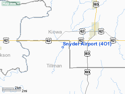
Location & QuickFacts
| FAA Information Effective: | 2008-09-25 |
| Airport Identifier: | 4O1 |
| Airport Status: | Operational |
| Longitude/Latitude: | 099-00-50.5000W/34-37-39.3000N
-99.014028/34.627583 (Estimated) |
| Elevation: | 1325 ft / 403.86 m (Estimated) |
| Land: | 14 acres |
| From nearest city: | 4 nautical miles SW of Snyder, OK |
| Location: | Tillman County, OK |
| Magnetic Variation: | 08E (1985) |
Owner & Manager
| Ownership: | Privately owned |
| Owner: | Snyder Spraying Service, Inc. |
| Address: | Po Box 280
Snyder, OK 73566 |
| Phone number: | 580-569-2153 |
| Manager: | Gerald Schulz |
| Address: | Po Box 280
Snyder, OK 73566 |
| Phone number: | 580-569-2222 |
Airport Operations and Facilities
| Airport Use: | Open to public |
| Wind indicator: | Yes |
| Segmented Circle: | No |
| Control Tower: | No |
| Landing fee charge: | No |
| Sectional chart: | Dallas-ft Worth |
| Region: | ASW - Southwest |
| Boundary ARTCC: | ZFW - Fort Worth |
| Tie-in FSS: | MLC - Mc Alester |
| FSS on Airport: | No |
| FSS Toll Free: | 1-800-WX-BRIEF |
| NOTAMs Facility: | MLC (NOTAM-d service avaliable) |
Airport Communications
Airport Services
| Fuel available: | 100LL
FUEL AVBL ON REQ CALL 580-569-2153/2222. |
| Airframe Repair: | NONE |
| Power Plant Repair: | NONE |
Runway Information
Runway 17/35
| Dimension: | 2125 x 30 ft / 647.7 x 9.1 m |
| Surface: | ASPH, Good Condition |
| |
Runway 17 |
Runway 35 |
| Traffic Pattern: | Left | Left |
| Obstruction: | , 50:1 slope to clear
+3 FT WIRE FENCE 58 FT FM RY END. +6 FT STEEL POSTS 78 FT RIGHT OF THLD. | 45 ft trees, 250.0 ft from runway, 90 ft left of centerline, 1:1 slope to clear
+45 FT TREES 130 FT FM RY END AND 100 FT LEFT. |
|
Radio Navigation Aids
| ID |
Type |
Name |
Ch |
Freq |
Var |
Dist |
| FSI | FAN MARKER | Trail | | | 09E | 31.6 nm |
| VRT | NDB | Wilbarger | | 230.00 | 08E | 27.5 nm |
| PFL | NDB | Post | | 308.00 | 08E | 30.2 nm |
| OFZ | NDB | Trail | | 388.00 | 09E | 31.6 nm |
| SHP | TACAN | Sheppard | 045X | | 10E | 46.8 nm |
| LAW | VOR/DME | Lawton | 031X | 109.40 | 09E | 30.8 nm |
| LTS | VORTAC | Altus | 035X | 109.80 | 08E | 12.9 nm |
| HBR | VORTAC | Hobart | 055X | 111.80 | 10E | 14.6 nm |
| BFV | VORTAC | Burns Flat | 037X | 110.00 | 08E | 37.8 nm |
| SPS | VORTAC | Wichita Falls | 074X | 112.70 | 10E | 43.8 nm |
Images and information placed above are from
http://www.airport-data.com/airport/4O1/
We thank them for the data!
| General Info
|
| Country |
United States
|
| State |
OKLAHOMA
|
| FAA ID |
4O1
|
| Latitude |
34-37-39.300N
|
| Longitude |
099-00-50.500W
|
| Elevation |
1325 feet
|
| Near City |
SNYDER
|
We don't guarantee the information is fresh and accurate. The data may
be wrong or outdated.
For more up-to-date information please refer to other sources.
|
|


