 |
|
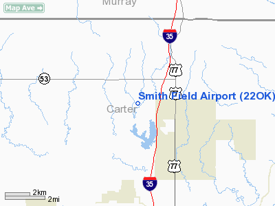
Location & QuickFacts
| FAA Information Effective: | 2008-09-25 |
| Airport Identifier: | 22OK |
| Airport Status: | Operational |
| Longitude/Latitude: | 097-10-33.0000W/34-18-55.0000N
-97.175833/34.315278 (Estimated) |
| Elevation: | 860 ft / 262.13 m (Estimated) |
| Land: | 0 acres |
| From nearest city: | 2 nautical miles W of Springer, OK |
| Location: | Carter County, OK |
| Magnetic Variation: | () |
Owner & Manager
| Ownership: | Privately owned |
| Owner: | Casey B. Smith |
| Address: | P. O. Box 26
Springer, OK 73458 |
| Phone number: | 580-653-2499 |
| Manager: | Casey B. Smith |
| Address: | P. O. Box 26
Springer, OK 73458 |
| Phone number: | 580-653-2499 |
Airport Operations and Facilities
| Airport Use: | Private |
| Control Tower: | No |
| Sectional chart: | Dallas-ft Worth |
| Region: | ASW - Southwest |
| Boundary ARTCC: | ZFW - Fort Worth |
| Tie-in FSS: | MLC - Mc Alester |
| FSS Toll Free: | 1-800-WX-BRIEF |
Runway Information
Runway 17/35
| Dimension: | 2000 x 50 ft / 609.6 x 15.2 m |
| Surface: | TURF, |
| |
Runway 17 |
Runway 35 |
| Traffic Pattern: | Left | Left |
|
Radio Navigation Aids
| ID |
Type |
Name |
Ch |
Freq |
Var |
Dist |
| AUV | NDB | Arbuckle | | 284.00 | 07E | 10.2 nm |
| PVJ | NDB | Pauls Valley | | 384.00 | 06E | 24.2 nm |
| GLE | NDB | Gainesville | | 330.00 | 06E | 35.9 nm |
| DNI | NDB | Denison | | 341.00 | 06E | 38.8 nm |
| DUA | NDB | Durant | | 359.00 | 05E | 44.6 nm |
| DUC | VOR/DME | Duncan | 047X | 111.00 | 09E | 37.0 nm |
| ADH | VOR/DME | Ada | 125X | 117.80 | 06E | 38.5 nm |
| URH | VOR/DME | Texoma | 090X | 114.30 | 05E | 44.9 nm |
| ADM | VORTAC | Ardmore | 114X | 116.70 | 06E | 6.2 nm |
Remarks
- 268 FT TWR & 320 FT TWR 7500 FT E, 403 FT TWR 9200 FT SE OF ARPT.
Images and information placed above are from
http://www.airport-data.com/airport/22OK/
We thank them for the data!
|
|


