 |
|
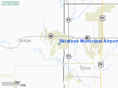
Location & QuickFacts
| FAA Information Effective: | 2008-09-25 |
| Airport Identifier: | 2F6 |
| Airport Status: | Operational |
| Longitude/Latitude: | 096-00-39.4400W/36-21-18.3800N
-96.010956/36.355106 (Estimated) |
| Elevation: | 670 ft / 204.22 m (Estimated) |
| Land: | 86 acres |
| From nearest city: | 1 nautical miles SW of Skiatook, OK |
| Location: | Osage County, OK |
| Magnetic Variation: | 06E (1985) |
Owner & Manager
| Ownership: | Publicly owned |
| Owner: | Town Of Skiatook |
| Address: | Town Offices Po Box 399
Skiatook, OK 74070 |
| Phone number: | 918-396-2797 |
| Manager: | Martin Tucker
TOWN COORDINATOR. |
| Address: | 110 N Broadway, Po Box 399
Skiatook, OK 74070 |
| Phone number: | 918-396-2797 |
Airport Operations and Facilities
| Airport Use: | Open to public |
| Wind indicator: | Yes |
| Segmented Circle: | Yes |
| Control Tower: | No |
| Lighting Schedule: | DUSK-DAWN |
| Beacon Color: | Clear-Green (lighted land airport)
ROTG BCN OTS INDEFLY. |
| Landing fee charge: | No |
| Sectional chart: | Kansas City |
| Region: | ASW - Southwest |
| Boundary ARTCC: | ZKC - Kansas City |
| Tie-in FSS: | MLC - Mc Alester |
| FSS on Airport: | No |
| FSS Toll Free: | 1-800-WX-BRIEF |
| NOTAMs Facility: | MLC (NOTAM-d service avaliable) |
| Federal Agreements: | NGY |
Airport Communications
| CTAF: | 122.800 |
| Unicom: | 122.800 |
Airport Services
| Fuel available: | 100LL
FUEL AVBL 24 HRS WITH CREDIT CARD. |
| Bottled Oxygen: | NONE |
| Bulk Oxygen: | NONE |
Runway Information
Runway 17/35
| Dimension: | 2900 x 60 ft / 883.9 x 18.3 m |
| Surface: | ASPH, Good Condition |
| Weight Limit: | Single wheel: 4000 lbs.
SPONSOR IMPOSED. |
| Edge Lights: | Medium
MIRL OTS INDEFLY. |
| |
Runway 17 |
Runway 35 |
| Longitude: | 096-00-39.2900W | 096-00-39.5900W |
| Latitude: | 36-21-32.7200N | 36-21-04.0400N |
| Elevation: | 670.00 ft | 670.00 ft |
| Alignment: | 127 | 0 |
| Traffic Pattern: | Left | Left |
| Markings: | Basic, Good Condition | Basic, Good Condition |
| Crossing Height: | 35.00 ft | 35.00 ft |
| VASI: | 2-light PAPI on left side | 2-light PAPI on left side |
| Visual Glide Angle: | 3.25° | 3.25° |
| Obstruction: | , 50:1 slope to clear | 25 ft tree, 300.0 ft from runway, 30 ft right of centerline, 4:1 slope to clear |
|
Runway N/S
| Dimension: | 2600 x 40 ft / 792.5 x 12.2 m |
| Surface: | TURF, Fair Condition |
| |
Runway N |
Runway S |
| Longitude: | 096-00-37.1100W | 096-00-37.3800W |
| Latitude: | 36-21-30.7300N | 36-21-05.0200N |
| Elevation: | 670.00 ft | 670.00 ft |
| Alignment: | 127 | 0 |
| Traffic Pattern: | Left | Left |
|
Radio Navigation Aids
| ID |
Type |
Name |
Ch |
Freq |
Var |
Dist |
| DW | NDB | Owaso | | 375.00 | 06E | 7.2 nm |
| OWP | NDB | William Pogue | | 362.00 | 06E | 13.0 nm |
| TZO | NDB | Bristow | | 251.00 | 05E | 40.5 nm |
| CUH | NDB | Cushing | | 242.00 | 05E | 46.5 nm |
| CFV | NDB | Coffeyville | | 212.00 | 05E | 49.2 nm |
| GNP | VOR/DME | Glenpool | 043X | 110.60 | 06E | 26.2 nm |
| BVO | VOR/DME | Bartlesville | 126X | 117.90 | 08E | 28.8 nm |
| OKM | VOR/DME | Okmulgee | 096X | 114.90 | 08E | 40.4 nm |
| TUL | VORTAC | Tulsa | 091X | 114.40 | 08E | 14.4 nm |
| TUL | VOT | Tulsa Intl | | 109.00 | | 14.4 nm |
Images and information placed above are from
http://www.airport-data.com/airport/2F6/
We thank them for the data!
| General Info
|
| Country |
United States
|
| State |
OKLAHOMA
|
| FAA ID |
2F6
|
| Latitude |
36-21-25.326N
|
| Longitude |
096-00-40.988W
|
| Elevation |
670 feet
|
| Near City |
SKIATOOK
|
We don't guarantee the information is fresh and accurate. The data may
be wrong or outdated.
For more up-to-date information please refer to other sources.
|
|


