 |
|
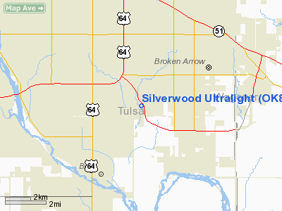
Silverwood Ultralight Airport |
Location & QuickFacts
| FAA Information Effective: | 2008-09-25 |
| Airport Identifier: | OK88 |
| Airport Status: | Operational |
| Longitude/Latitude: | 095-50-36.9580W/36-00-36.3550N
-95.843599/36.010099 (Estimated) |
| Elevation: | 632 ft / 192.63 m (Estimated) |
| Land: | 40 acres |
| From nearest city: | 3 nautical miles W of Broken Arrow, OK |
| Location: | Tulsa County, OK |
| Magnetic Variation: | 06E (1990) |
Owner & Manager
| Ownership: | Privately owned |
| Owner: | Wayne Crain |
| Address: | 4300 South Butternut
Broken Arrow, OK 74102 |
| Phone number: | 918-250-6586 |
| Manager: | Wayne Crain |
| Address: | 4300 South Butternut
Broken Arrow, OK 74102 |
| Phone number: | 918-250-6586 |
Airport Operations and Facilities
| Airport Use: | Private |
| Segmented Circle: | No |
| Control Tower: | No |
| Sectional chart: | Kansas City |
| Region: | ASW - Southwest |
| Boundary ARTCC: | ZKC - Kansas City |
| Tie-in FSS: | MLC - Mc Alester |
| FSS on Airport: | No |
| FSS Toll Free: | 1-800-WX-BRIEF |
Runway Information
Runway 17/35
| Dimension: | 1357 x 200 ft / 413.6 x 61.0 m |
| Surface: | TURF, |
| |
Runway 17 |
Runway 35 |
| Traffic Pattern: | Left | Left |
|
Radio Navigation Aids
| ID |
Type |
Name |
Ch |
Freq |
Var |
Dist |
| DW | NDB | Owaso | | 375.00 | 06E | 17.9 nm |
| OWP | NDB | William Pogue | | 362.00 | 06E | 18.0 nm |
| TZO | NDB | Bristow | | 251.00 | 05E | 31.8 nm |
| MKO | NDB | Muskogee | | 306.00 | 06E | 36.9 nm |
| HET | NDB | Henryetta | | 267.00 | 04E | 37.3 nm |
| TQH | NDB | Tahlequah | | 215.00 | 05E | 41.1 nm |
| CUH | NDB | Cushing | | 242.00 | 05E | 45.9 nm |
| MEE | VOR | Davis | | 108.60 | 06E | 31.2 nm |
| GNP | VOR/DME | Glenpool | 043X | 110.60 | 06E | 8.1 nm |
| OKM | VOR/DME | Okmulgee | 096X | 114.90 | 08E | 19.1 nm |
| TUL | VORTAC | Tulsa | 091X | 114.40 | 08E | 11.5 nm |
| TUL | VOT | Tulsa Intl | | 109.00 | | 11.5 nm |
Remarks
- PRVDD SITE IS USED AS ULTRALIGHT FLIGHT PARK/HELIPORT.
Images and information placed above are from
http://www.airport-data.com/airport/OK88/
We thank them for the data!
| General Info
|
| Country |
United States
|
| State |
OKLAHOMA
|
| FAA ID |
OK88
|
| Latitude |
36-00-36.355N
|
| Longitude |
095-50-36.958W
|
| Elevation |
632 feet
|
| Near City |
BROKEN ARROW
|
We don't guarantee the information is fresh and accurate. The data may
be wrong or outdated.
For more up-to-date information please refer to other sources.
|
|


